EN
产品
测绘地信
精准农业
地基增强
数字施工
物联网
无人系统
电信通信
测绘RTK
GNSS分体机
手簿平板
软件平台
全站仪
GNSS 天线
开发模块
电台
配件
Horus
视觉激光 RTK
Orion ONE
激光视觉RTK
Orion ONE-L
激光测量RTK
Orion ONE-AR
实景放样RTK
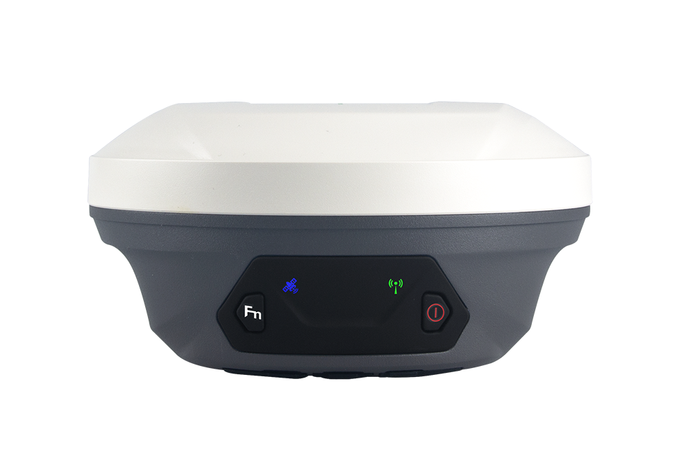
X1
全能型RTK
X1 PRO
全能屏显RTK
X1 Lite
经济全能RTK
Xbase
专业基站
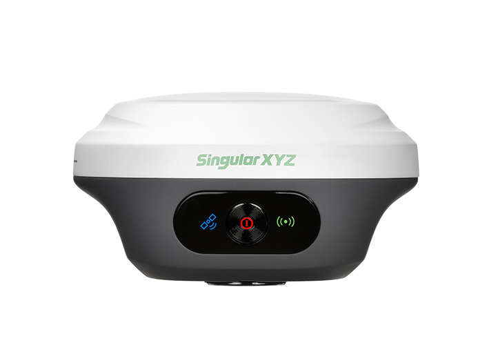
E1
全能型RTK
E1 Pro
全能屏显RTK
E1 Lite
经济全能RTK
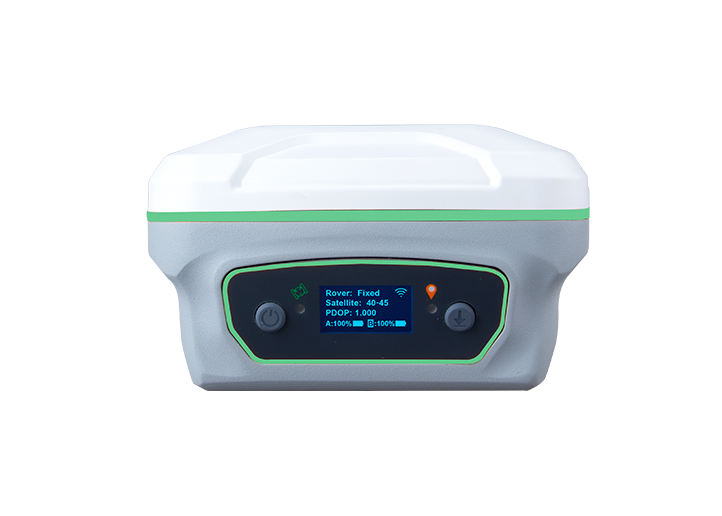
Z1
掌上惯导RTK
Z1 Lite
掌上入门RTK
Y1
全能性RTK
P2 Plus
穿戴式加强RTK
P2
穿戴式RTK
Sfaira ONE Plus
便携式惯导RTK
Sfaira ONE
便携式RTK
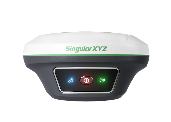
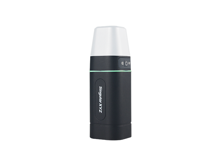
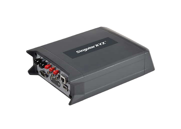
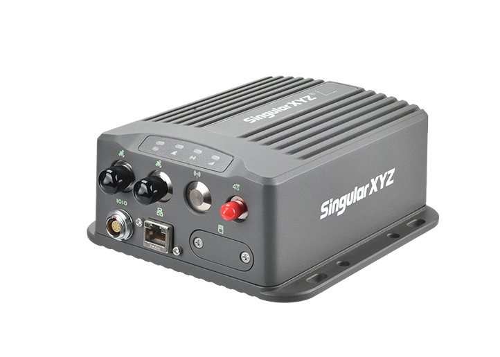
N1
GNSS 接收机
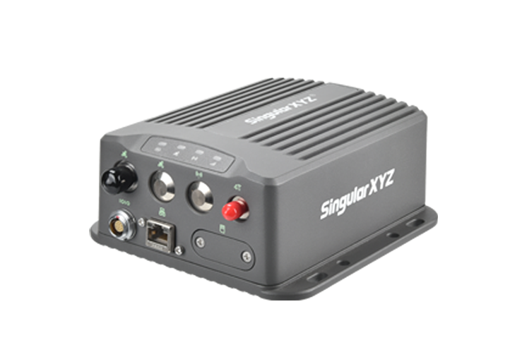
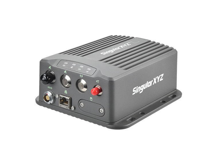
SV100
GNSS 接收机
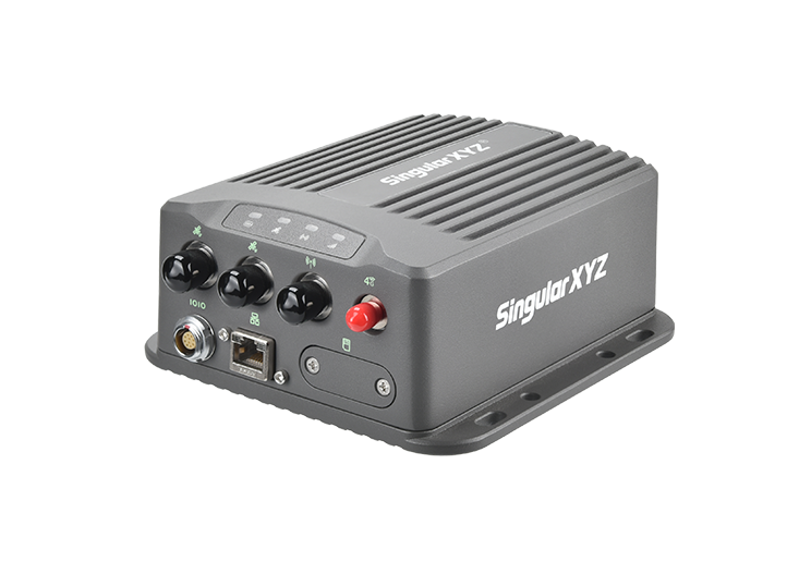
SV100 Dual
GNSS 接收机
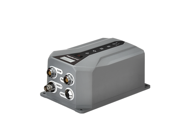
FOG100
GNSS+INS 组合导航接收机
SV100 INS-D
组合导航接收机
SV100 INS
组合导航接收机
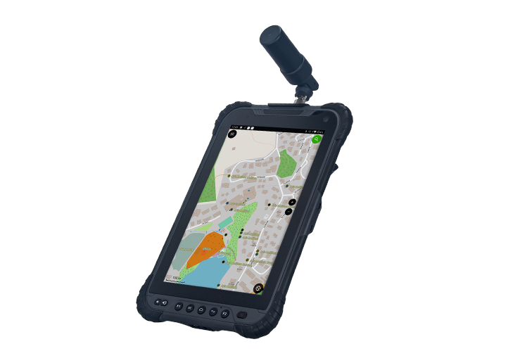
T8 Pro
平板
SC300
手簿
SC200
手簿
T8 平板
SingularPad 工程通外业测量软件
SingularCaster Ntrip Caster 平台
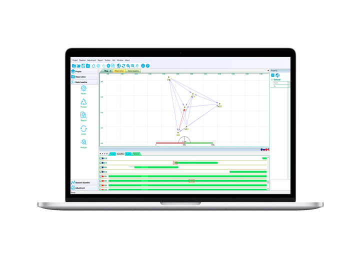
PProcessing
后处理软件
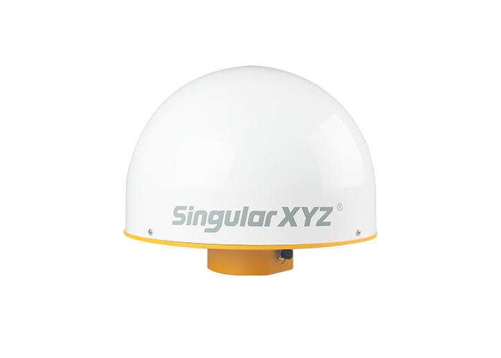
SA100
GNSS 天线
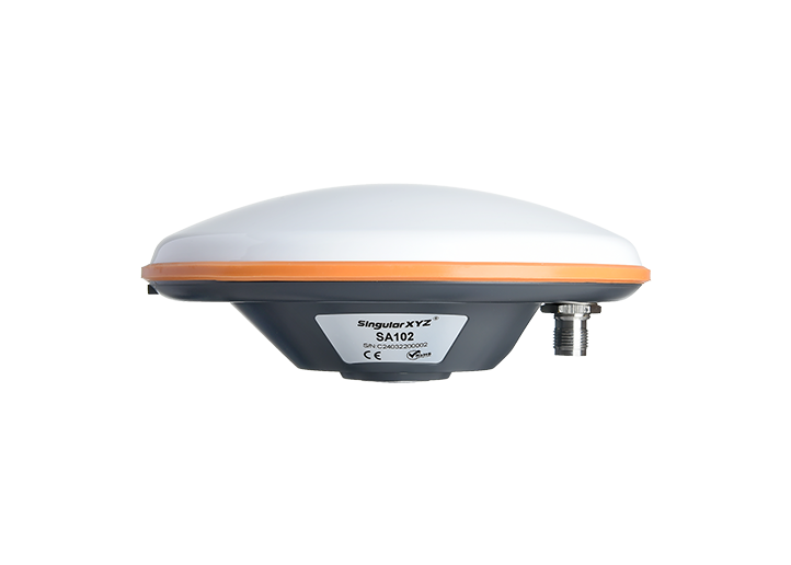
SA102
GNSS天线
SA500扼流圈
GNSS天线
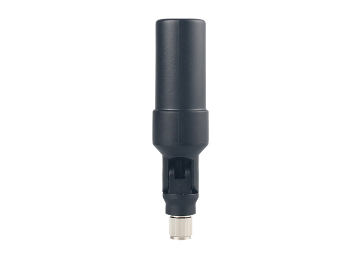
SA180 螺旋式 GNSS 天线
DK100
开发套件
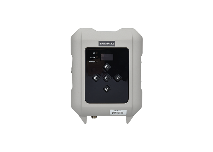
SDL2 外挂电台
数据传输单元
测杆与标杆
三脚架与基座
棱镜
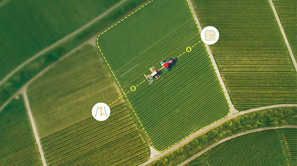
农机自动驾驶系统
农机作业引导系统
土地整平系统
农业基站
电台
系统组件
RTK接收机
SAgro200
自动驾驶系统
SV100
GNSS 接收机
农机导航智能基站
S20
GNSS 接收机
GNSS接收机
软件平台
N1
GNSS 接收机
SV100
GNSS 接收机
SingularCaster Ntrip Caster 平台
桩机引导系统
导航接收机
GNSS天线
基准站
电台
SV100
GNSS 接收机
SV100 Dual
GNSS 接收机
FOG100
GNSS+INS 组合导航接收机
SV100 INS-D
组合导航接收机
SV100 INS
组合导航接收机
S20
GNSS 接收机
SA100
GNSS 天线
SA102
GNSS天线
SV100
GNSS 接收机
农机导航智能基站
RTK接收机
RTK分体机
软件平台
P2 Plus
穿戴式加强RTK
P2
穿戴式RTK
SV100
GNSS 接收机
SV100 Dual
GNSS 接收机
FOG100
GNSS+INS 组合导航接收机
SV100 INS-D
组合导航接收机
SV100 INS
组合导航接收机
导航接收机
GNSS模块
SV100
GNSS 接收机
SV100 Dual
GNSS 接收机
FOG100
GNSS+INS 组合导航接收机
SV100 INS-D
组合导航接收机
SV100 INS
组合导航接收机
授时接收机
姿态接收机
解决方案
测绘地信
精准农业
地基增强
数字施工
物联网
GNSS土地测绘方案
CORS 网络解决方案
GIS 数据采集解决方案
农田要素测绘解决方案
S20 高性价比 CORS 解决方案
GNSS基准站系统解决方案
CORS 网络解决方案
GNSS 导航与引导解决方案
P2 人员追踪安全解决方案
支持
技术支持
联系支持团队
下载中心
视频中心
博客问答
博客
常见问题
关于我们
公司简介
新闻动态
展会活动
加入我们
用户社区
联系销售
成为经销商
产品咨询
获取报价
联系销售
EN
产品
ALL
测绘地信
测绘RTK
GNSS分体机
手簿平板
软件平台
全站仪
GNSS 天线
开发模块
电台
配件
Horus
视觉激光 RTK
Orion ONE
激光视觉RTK
Orion ONE-L
激光测量RTK
Orion ONE-AR
实景放样RTK
X1
全能型RTK
X1 PRO
全能屏显RTK
X1 Lite
经济全能RTK
Xbase
专业基站
E1
全能型RTK
E1 Pro
全能屏显RTK
E1 Lite
经济全能RTK
Z1
掌上惯导RTK
Z1 Lite
掌上入门RTK
Y1
全能性RTK
P2 Plus
穿戴式加强RTK
P2
穿戴式RTK
Sfaira ONE Plus
便携式惯导RTK
Sfaira ONE
便携式RTK
N1
GNSS 接收机
SV100
GNSS 接收机
SV100 Dual
GNSS 接收机
FOG100
GNSS+INS 组合导航接收机
SV100 INS-D
组合导航接收机
SV100 INS
组合导航接收机
T8 Pro
平板
SC300
手簿
SC200
手簿
T8 平板
SingularPad 工程通外业测量软件
SingularCaster Ntrip Caster 平台
PProcessing
后处理软件
SA100
GNSS 天线
SA102
GNSS天线
SA500扼流圈
GNSS天线
SA180 螺旋式 GNSS 天线
DK100
开发套件
SDL2 外挂电台
数据传输单元
测杆与标杆
三脚架与基座
棱镜
精准农业
农机自动驾驶系统
农机作业引导系统
土地整平系统
农业基站
电台
系统组件
RTK接收机
SAgro200
自动驾驶系统
SV100
GNSS 接收机
农机导航智能基站
S20
GNSS 接收机
地基增强
GNSS接收机
软件平台
N1
GNSS 接收机
SV100
GNSS 接收机
SingularCaster Ntrip Caster 平台
数字施工
桩机引导系统
导航接收机
GNSS天线
基准站
电台
SV100
GNSS 接收机
SV100 Dual
GNSS 接收机
FOG100
GNSS+INS 组合导航接收机
SV100 INS-D
组合导航接收机
SV100 INS
组合导航接收机
S20
GNSS 接收机
SA100
GNSS 天线
SA102
GNSS天线
SV100
GNSS 接收机
农机导航智能基站
物联网
RTK接收机
RTK分体机
软件平台
P2 Plus
穿戴式加强RTK
P2
穿戴式RTK
SV100
GNSS 接收机
SV100 Dual
GNSS 接收机
FOG100
GNSS+INS 组合导航接收机
SV100 INS-D
组合导航接收机
SV100 INS
组合导航接收机
无人系统
导航接收机
GNSS模块
SV100
GNSS 接收机
SV100 Dual
GNSS 接收机
FOG100
GNSS+INS 组合导航接收机
SV100 INS-D
组合导航接收机
SV100 INS
组合导航接收机
电信通信
授时接收机
姿态接收机
解决方案
ALL
测绘地信
GNSS土地测绘方案
CORS 网络解决方案
GIS 数据采集解决方案
精准农业
农田要素测绘解决方案
S20 高性价比 CORS 解决方案
地基增强
GNSS基准站系统解决方案
CORS 网络解决方案
数字施工
GNSS 导航与引导解决方案
物联网
P2 人员追踪安全解决方案
支持
技术支持
联系支持团队
下载中心
视频中心
博客问答
博客
常见问题
关于我们
公司简介
新闻动态
展会活动
加入我们
用户社区
联系销售
成为经销商
产品咨询
获取报价
全部
产品中心
解决方案
博客 & FAQs
新闻动态
展会活动
下载中心
视频中心
产品中心
Horus
视觉激光 RTK
以视觉驱动,重新定义测量
Orion ONE
激光视觉RTK
视觉、激光、惯导
开启全新测量体验
Orion ONE-L
激光测量RTK
激光无接触,测量更自由
Orion ONE-AR
实景放样RTK
星光级摄像头,沉浸式AR放样体验
X1
全能型RTK
更小机身,更强性能
X1 PRO
全能屏显RTK
升级高清彩屏,满足您的所有需求
X1 Lite
经济全能RTK
专业测绘,高性价比之选
Xbase
专业基站
为远距通信打造,为基站应用设计
E1
全能型RTK
轻量化设计,专业级输出
E1 Pro
全能屏显RTK
高清彩屏升级,外业体验更进一步
E1 Lite
经济全能RTK
专业测绘,经济实用
Z1
掌上惯导RTK
精准测量,尽在掌中
Z1 Lite
掌上入门RTK
掌心级入门 RTK
Y1
全能性RTK
性能强劲,功能全面,小巧便携,性价比出众
P2 Plus
穿戴式加强RTK
轻盈可穿戴,适配 GIS 与测绘作业
P2
穿戴式RTK
精准、预警、可穿戴:升级施工安全防护
Sfaira ONE Plus
便携式惯导RTK
轻松测绘,精准定位
升级 60° 倾斜 IMU 加持
Sfaira ONE
便携式RTK
入门级网络 RTK 移动站
专业性能不打折
N1
GNSS 接收机
可靠专业的参考站
SV100
GNSS 接收机
专为参考站与便携式基站场景设计
SV100 Dual
GNSS 接收机
专为车辆导航与机械引导设计
FOG100
GNSS+INS 组合导航接收机
卫星定位+惯性导航,无惧信号中断
SV100 INS-D
组合导航接收机
卫导惯导融合,信号中断仍保精准
SV100 INS
组合导航接收机
卫导惯导融合,信号中断仍保精准
T8 Pro
平板
便携精准,适配 GIS 与测绘场景
SC300
手簿
应对各类任务的可靠伙伴
SC200
手簿
以高效与耐用赋能外业
T8 平板
清晰流畅的外业体验
SingularPad 工程通外业测量软件
项目作业的专业助手
SingularCaster Ntrip Caster 平台
智能管理您的 CORS 网络
PProcessing
后处理软件
实现高精度计算
SA100
GNSS 天线
卫星导航技术应用的优秀伙伴
SA102
GNSS天线
卫星导航技术应用的优秀伙伴
SA500扼流圈
GNSS天线
专为监测与 CORS 网络设计
SA180 螺旋式 GNSS 天线
专为手持设备及无人系统设计
SDL2 外挂电台
稳定兼容,拓展您的 RTK 覆盖范围
DK100
开发套件
开箱即用,让您的 GNSS 开发更轻松
数据传输单元
通过以太网传输差分数据
测杆与标杆
专为精密测量设计
三脚架与基座
专为 RTK 基准站及全站仪设计
棱镜
专为全站仪测量设计
SAgro200
自动驾驶系统
智能天线设计,简化您的农事操作
农机导航智能基站
自动启动,自动匹配 —— 精准省力
S20
GNSS 接收机
精准导航,精细耕作
解决方案
GNSS土地测绘方案
Learn More
农田要素测绘解决方案
Learn More
S20 高性价比 CORS 解决方案
Learn More
GNSS基准站系统解决方案
Learn More
GNSS 导航与引导解决方案
Learn More
P2 人员追踪安全解决方案
Learn More
CORS 网络解决方案
Learn More
CORS 网络解决方案
Learn More
GIS 数据采集解决方案
Learn More
博客
地理空间 RTK GNSS 接收机
技术角 | 编码库工作流程(第一部分):创建和管理代码列表
本篇博客将深入探讨如何在SingularPad软件中创建代码库,因为其最新几个版本中已推出了多项功能更新。
方位角 RTK 测量 GNSS
技术角 | 如何使用方位角和距离放样点位
在一些国家,比如美国、加拿大,或者欧洲的部分地区 —— 尤其是在处理旧版测量地图或地籍图时 —— 点位不是通过坐标来描述的,而是通过它们的方位角和距离关系来表示的。
地理空间 RTK GNSS 接收机 IMU
技术角 | 解析 RTK GNSS 接收机的主要功能模块
本系列文章将继续为您介绍,今天的博客将聚焦接收机主板上集成的主要功能模块。这些组件对于实现高精度定位以及赋能智能野外应用而言至关重要。
地理空间 RTK GNSS 接收机
技术角 | 了解 RTK GNSS 接收机中的通信接口
在本篇博客中,我们将重点探讨主板内置的通信系统。本系列的后续文章会对其他部件进行讨论。
自动驾驶 GNSS PPP
技术角 | 如何在自动导航系统中激活PPP(精密单点定位)
在田间使用自动导航系统时,有时可能会遇到没有网络覆盖或没有RTK基准站的区域。但即便如此,你可能仍希望不间断地继续作业。这时候,PPP(精密单点定位)就派上用场了。
地理信息 RTK GNSS 接收机
技术角 | 全球导航卫星系统(GNSS)接收机的内部构造是什么?- 其核心组件解析
大多数测量员都十分熟悉全球导航卫星系统(GNSS)接收机的各种型号和功能——但你是否曾好奇,在那紧凑而坚固的外壳内部隐藏着什么呢?
GNSS 天线 RTK
技术角 | 全球导航卫星系统(GNSS)天线的主要类型及其用途是什么
无论是进行厘米级土地测量、精准农业还是车辆导航,了解天线类型并选择合适的天线,都能直接影响你的定位性能。
RTCM 基站
技术角 | S20智能天线基站的RTCM输出设置
S20是一款智能GNSS天线,它将天线与GNSS引擎集成在一个紧凑的单元中。该设备专为轻松集成到第三方农业系统而设计,能够提供可靠的高精度定位服务。
GNSS GPS
技术角 | GNSS频段与多频技术分析
在本文中,我们将探讨多频GNSS的核心概念,分析主要GNSS系统的频段,并阐述多频技术如何提升GNSS性能。
RTK GNSS
技术角 | RTK 定位精度受哪些因素影响?以及如何提升稳定性
在这篇博客中,让我们探讨影响 RTK固定率的主要因素,更重要的是,您可以应用哪些措施来提高现场的接收机固定性能。
激光测量 RTK
技术角 | 激光放样 - 快速、无接触的放样点检查方法
AR 放样功能可以通过摄像头将点的位置映射到现实世界中,提供直观的方向指引,而内置激光模块则为放样带来了更多便利。那么,激光究竟该如何用于放样呢?
AR 摄像机 GNSS
技术交流 | AR 放样 简介
近年来,AR(增强现实)技术为传统的 GNSS 放样工作带来了全新的视觉体验。在本篇博客中,我们将深入了解 AR 放样的工作原理以及它在时空奇点解决方案中的应用。
全站仪
技术交流 | 了解全站仪的PTL功能
点到线 (PTL) 功能是全站仪中一种高级的数据处理工具,旨在确定测量点和参考线之间的相对位置。
PPP SBAS CORS RTK GNSS
技术聊天 | 根据需求选择合适你的GIS模式
在此博客中,我们分析了 CORS、PPP 和 SBAS 工作模式之间的差异,比较了时空奇点的 GIS 解决方案,并提供了分步教程来帮助您优化工作流程。
RTK GNSS
技术聊天 | 如何从前面板读取接收器状态?
在这篇博客中,我们将以 X1 系列的 GNSS 接收器为例来解释这些指示灯和按钮的含义。
地理空间 RTK GNSS接收机
技术聊天| 解决 RTK 测量和放样中的坐标不匹配问题
我们的支持团队经常被问到的一个问题是如何处理设计图纸和 RTK 测量结果之间的坐标不匹配问题。时空奇点软件中的计算转换参数功能正是为解决这一问题而设计的。
自动驾驶 GNSS
技术聊天 | 如何有效地管理不同农场和地块之间的任务?
使用自动驾驶套件时,工作人员通常会在多个地块甚至不同的农场之间作业。在本篇博客中,我们将介绍如何通过将导航线任务分类到特定的农场和地块来有效地管理导航线任务。
地理空间 RTK GNSS 接收机r
技术聊天 | 如何访问 Z1 GNSS 接收机的网页?
如果您正在使用 Z1 GNSS 接收机,有时可能需要访问其网页来下载静态数据、更新固件或其他操作。在本篇博客中,我们将指导您完成访问 Z1 网页界面。
技术聊天 | 怎么把工程通许可证转到新设备里?
在使用工程通的过程中,您可能需要切换设备,例如您的安卓 手簿损坏或升级到新设备时。本博客将指导您如何将许可证转移到新设备。
地理空间 RTK GNSS接收机
技术交流| 如何选择你的RTK之2025年度时空奇点GNSS接收机系列大比较
在这篇博客中, 我们提供了GNSS接收机的最新比较,从而帮助你依据最新的型号、性能规格和主要功能来做出相应选择
AR camera GNSS
Tech Chat | Mastering Visual AR Stakeout with Orion ONE
The Visual AR Stakeout feature of the Orion ONE RTK receiver brings a new level of efficiency to field surveying. In this blog, we'll walk you through the steps to effectively use Visual AR Stakeout with Orion ONE.
Geospatial RTK GNSS Receiver Laser surveying
Tech Chat | Mastering Laser Surveying with Orion ONE
To facilitate everyone's use and to demonstrate the operation to interested professionals, in today's blog, we will introduce in detail how to use the laser surveying function and related precautions.
Geospatial RTK GNSS Receiver AR stakeout Laser surveying
SingularXYZ FAQ | Orion ONE's Laser, AR & Performance Features Explained
In our previous blog, we focused on the laser surveying capabilities of the Orion ONE visual and laser RTK receiver. Today, we’ll address more FAQs, including laser surveying limitations, AR stakeout WiFi usage...
Geospatial RTK GNSS Receiver Laser surveying
FAQ | Common Questions About Orion ONE Laser Surveying
Since the release of the Orion ONE visual and laser RTK receiver, we've received some questions from users curious about its new laser surveying function. In this blog, we'll address some of the FAQs.
Geospatial RTK GNSS Receiver Safety
Tech Chat | How to Add and Connect Devices to the SingularThings IoT Platform?
In this blog, we'll walk you through adding and connecting P2 devices to the SingularThings platform, followed by an overview of its customizable features.
Geospatial Total station
Tech Chat | Understanding Different Angle Units in Total Station Surveying
In surveying and mapping, angle measurements are vital, but different regions often use varying angle units. This blog will help you understand the differences between these units and guide you on how to switch it on TS1000 total station.
Geospatial CORS GNSS Receiver
Tech Chat | How to Upgrade SingularCaster Software
At the end of our last blog, we addressed common login issues with the SingularCaster software. In this blog, we'll provide a step-by-step guide to properly reinstall and update the SingularCaster software.
Geospatial RTK GNSS Receiver PPP SBAS
Tech Chat | How to Enable SBAS and PPP Mode on Sfaira ONE Series
In this blog, we'll guide you through enabling the SBAS and PPP functions on the Sfaira ONE Series receiver. For a detailed introduction to these technologies, check out our previous blogs:
Geospatial Static GNSS Receiver
Tech Chat | How to Obtain GNSS Static Data With Sfaira ONE Series?
Recently, Sfaira ONE Series users have also expressed interest in obtaining static data, although this model lacks internal storage. In this blog, we'll walk you through how to obtain static data from it via a Type-C USB cable for easy transfer.
Autosteer GNSS Tablet Crash
Tech Chat | How to Resolve Stuck or Crashing Issues in Autosteer Software?
Recently, we've received feedback from users experiencing lag or crashes when running PrecisionAg Autosteer software on the T10 tablet. This blog will show you how to troubleshoot and fix these issues.
Geospatial RTK GNSS Receiver
Tech Chat | Understanding The Meaning & Accuracy of Common RTK Solutions
In daily GNSS RTK surveying, the RTK solution is an important indicator for positioning reliability and accuracy. In this blog, we will introduce the meaning of each RTK solution and its typical accuracy, and how do they affect your results?
Geospatial RTK GNSS Receiver RTKLIB
Tech Chat | STRSVR: A Key Tool for GNSS Data Transfer and Debugging
In the field of GNSS applications, a reliable tool for data transfer and debugging is sometimes very helpful. RTKLIB STRSVR serves as an easy-to-use network transfer auxiliary tool that supports various protocols.
Geospatial RTK SingularPad
Tech Chat | How to Activate SingularPad Software and Common Registration FAQs
In this blog, we'll walk you through the SingularPad registration process and address some common FAQs that may arise during activation.
Geospatial RTK Ntrip Caster CORS
FAQ | Troubleshooting Common Issues with SingularCaster Software
When managing a CORS network with SingularCaster, users may occasionally encounter login failures that disrupt their workflow. This blog will focus on common login problems associated with SingularCaster.
Geospatial RTK GNSS Receiver NMEA-0183
Tech Chat | Understanding NMEA Messages: Key to High-Precision Positioning
In the world of high-precision surveying, NMEA messages are essential for reliable communication between GNSS receivers and other devices. In this blog, we'll break down key NMEA messages.
Geospatial Total Station
FAQ | SingularXYZ TS1000 Total Station - Part 5 Solution of Data Conversion lssues
In a previous blog, we discussed how to use TS-Link to convert data into the format you need. In this blog, we will explore the common reasons behind these failures and provide a step-by-step solution to ensure successful data conversion.
Geospatial RTK IP LAN
Tech Chat | Understanding LAN, Public, and Static IPs in CORS Setup
For high-precision CORS networks, IP addresses are critical for communication between devices and network. This blog explains how each type of IP plays a role in managing and maintaining a stable CORS system.
Geospatial RTK GNSS Receiver Photovoltaic
Tech Chat | Simplifying Photovoltaic Stake-Out with SingularPad
In this blog, we will walk you through a step-by-step guide on conducting an efficient and accurate photovoltaic stake-out using SingularPad, ensuring your projects are executed with precision, regardless of the terrain.
Geospatial CORS Ntrip Caster
Tech Chat | How to Build a Personal Server for SingularCaster CORS Software
For CORS owners, to build a server for the CORS software/NtripCaster platform is the very first step. A stable network environment, high data processing capacity, and reliable long-term operation can guarantee better results.
Geospatial Total Station
FAQ | SingularXYZ TS1000 Total Station – Part 4 Station Occupation
This blog will guide you through the importance of station occupation and introduce various methods used to ensure precise measurements in complex engineering projects.
Geospatial RTK GNSS Receiver GNSS Antenna
Tech Chat | Understanding Antenna Phase Center & Its Calculation
In satellite positioning, the original calculated coordinates is the location of the GNSS antenna phase center (APC). In today's blog, we'll delve into what the antenna phase center is, how it's calculated...
Autosteer GNSS
Tech Chat | How to Get NMEA Messages from SAgro-Series Autosteer Kits
In modern agriculture, recording and monitoring field operations is essential for efficient farm management and data analysis. SingularXYZ autosteer software can record the operated area in real-time with 0.1 square meter accuracy.
Geospatial Total Station
FAQ | SingularXYZ TS1000 Total Station – Part 3 Data Format Conversion
In our previous blog, we discussed how to export data directly from a total station. In this blog, we will introduce how to convert the exported data into the format you need through conversion software.
Geospatial RTK GNSS Receiver APN 4G
Tech Chat | What is APN & How To Setup in SingularXYZ Products?
Understanding the role of APN (Access Point Name) is crucial for those who use mobile internet services. In this blog, we will explain what APN is, how it works, and how to configure it in SingularXYZ products.
Geospatial RTK GNSS Receiver Base
Tech Chat | Tips for Setting Up a Reliable Base Station
For beginners in RTK surveying, setting up the RTK base correctly and reliably can be challenging without proper guidance. In today's blog, we will cover essential tips to help you set up your base station correctly.
Geospatial RTK GNSS Receiver
Tech Chat | Evaluating RTK Accuracy in Different Dimensions
In the realm of surveying, ensuring the accuracy of your measurements is paramount. Understanding and evaluating the accuracy of your RTK surveying can significantly impact your results.
Geospatial RTK GNSS Receiver Test Report
Test Report | Sfaira ONE Performance in Different Environments
In this test report, we evaluate the performance of the Sfaira ONE Series, based on detailed testing conducted by our user Ari Kilpelä, D.Sc., CEO of Dimense Oy, sharing its accuracy, precision, and tilt capabilities in different environments.
Geospatial Total Station
FAQ | SingularXYZ TS1000 Total Station – Part 2 Data Import and Export
In our previous blog, we covered basic settings about TS1000. This blog will continue by introducing how to use a USB stick to import and export data, which is a crucial aspect of surveying data management.
Geospatial RTK Drone Mapping UAV
Tech Chat | Setting Up a Base Station for Drone Operations via Receiver’s Caster
In certain drone applications, like drone mapping or autonomous driving inspections, achieving centimeter-level accuracy is essential. This blog will guide you through setting up a base station through a WiFi connection.
Geospatial DDNS CORS
Tech Chat | How to Set Up DDNS for Remote Management of SV100 CORS Stations?
For CORS providers managing numerous stations, remote control of the CORS station becomes crucial. In today's blog, we will use the SV100 and the NO-IP service as an example to introduce how to set up the DDNS function.
Autosteer GNSS Demo
Tech Chat | How to Use the Demo Mode of Our SAgro-Series Systems?
There are scenarios where we need to make a demonstration but it's not convenient to install the system on a tractor, such as participating in trade shows, system testing. This blog will guide you through the steps to activate the demo mode.
Autosteer GNSS U-turn
Tech Chat | How to Use U-Turn Function in SAgro-Series Autosteer Kits?
In the ever-evolving world of agriculture, precision and efficiency are key. The SAgro-Series autosteer kits from SingularXYZ are helping farmers around the world enter the era of precision farming and improve their farming efficiency & quality.
Geospatial Azimuth Bearing Surveying
Tech Chat | Difference Between Azimuth and Bearing in Land Surveying
In the field of geodesy, azimuth and bearing are both for identifying directions and angle differences between points. Today's blog let's understand the differences between them to help surveyors ensure accurate survyeing.
Geospatial RTK GNSS Receiver Line Stakeout
Tech Chat | Line-related surveying tasks in SingularPad – Part 2 Stakeout
In the previous chapter, we explored various workflows for creating lines within SingularPad software. In this blog, let’s delve into conducting line stakeouts using different methods to cater to diverse tasks.
Autosteer GNSS Tractor
Tech Chat | Compatibility of SAgro-Series Autosteer Kits & Real User Cases
For those entering precision farming with systems like SAgro-Series autosteer kits, concerns often arise regarding compatibility with different tractors. In this blog, we delve into the specifics of compatibility across various tractor models.
Geospatial Surveying Map SingularPad
Tech Chat | How to Set & Calibrate Base Maps for Your Surveying Tasks?
In various surveying tasks and project scenarios, there are different requirements about the base maps. Tailored to meet such specific needs, SingularPad offers support for a range of base map types.
Geospatial Total Station FAQ
FAQ | SingularXYZ TS1000 Total Station – Part 1 Basic Settings
Drawing from our experience supporting TS1000 total station users, we've summarized some common settings in this blog to ensure your total station aligns perfectly with your needs.
Geospatial RTK GNSS Receiver Line Surveying
Tech Chat | Line-related surveying tasks in SingularPad – Part 1
In the realm of surveying, in addition to the basic point survey and stakeout, the line-related tasks are also very common and important. In this blog, let's look closely at the possible workflows about creating lines.
Geospatial RTK GNSS Receiver
Tech Chat | How to Tackle CORS Coverage Gaps via SingularXYZ Caster?
Here, we present a step-by-step guide of how to setup the X1-series as base station and deliver differential data to the Sfaira ONE series via SingularXYZ Caster over 4G, enabling you to undertake RTK measurements with ease.
Geospatial RTK GNSS Receiver AR
Tech Chat | Maximizing Stakeout Efficiency with SingularPad's AR Integration
As AR (Augmented Reality) technology continues to permeate various industries. By integrating AR into the SingularPad software’s stakeout function, surveyors can maximize stakeout efficiency through virtual guidance on the software.
Geospatial RTK GNSS Receiver Static
Tech Chat | How to record static data when the receiver is working as RTK Base?
Due to certain project specifications and accuracy verification requirements, sometimes our users will need to have the receiver record static data simultaneously while it is working as RTK base.
Geospatial RTK GNSS Receiver CORS
Tech Chat | A Comprehensive Introduction & Guide to CORS
In this blog, we will combine and summarize previous blogs and comprehensively introduce the definition, advantages, applications, construction and configuration of CORS to give you a complete understanding.
Geospatial RTK GNSS Receiver Antenna Height
Tech Chat | How To Measure & Set the Height of RTK Base Station?
When using GNSS receivers for surveying, accurately measuring antenna height is crucial for both static measurements and setting up RTK bases. In today's blog, we will explore how to measure and configure the antenna height.
Geospatial CORS Ntrip Caster Server
Tech Chat | How To Choose An Ideal Cloud Server For Your CORS Software?
In this blog post, we will delve into selecting the suitable cloud server for your CORS platform, including considerations for parameter selection, assisting you in configuring and managing your CORS effectively.
Geospatial RTK GNSS Receiver GIS
Tech Chat | How to Add Attributes to Measured Features During Surveys
As GISers and surveyors are familiar with, the geo-features come with a couple of attributes. Some are automatically generated based on the measured coordinates, such as the length of the line and the area of the surface.
Geospatial RTK GNSS Receiver
Tech Chat | Choose Your Right One - Exploring SingularXYZ GNSS Receiver Lineup
In this latest blog, let's delve deeper into a comprehensive comparison of all our GNSS receivers, exploring their unique features, functionalities, work modes, and application domains.
Geospatial RTK GNSS Receiver IMU
Tech Chat | How to Use Receiver IMU as a Compass for Stakeout?
Have you ever encountered challenges when staking out due to a failing controller compass? This blog will guide you through utilizing the receiver's IMU as a compass for stakeout, ensuring accurate navigation even when compasses fail.
Geospatial GNSS PPP Galieo HAS
Tech Chat | How to Use Galileo HAS?
In the last chapter, we introduced you to the transformative potential of Galileo's High Accuracy Service (HAS). Now, let's delve deeper into how our products seamlessly integrate with HAS.
Geospatial GNSS PPP Galieo HAS
Tech Chat | What is Galileo High Accuracy Service (HAS)?
As a cornerstone in Global Navigation Satellite Systems, Galileo has been a familiar presence in our daily lives. Since commencing testing and experimentation of the innovative High Accuracy Service (HAS) in 2019.
Geospatial RTK GNSS Receiver Surveying
Tech Chat | Enhancing Teamwork: Sharing Coordinate System Parameters in SingularPad Software
Effective communication is crucial for successful project execution. In this blog post, we'll explore how to effortlessly share these parameters with your fellow surveyors using the SingularPad software.
Geospatial Datum GNSS
Tech Chat | What is Datum? – Part 2 Explore Local Datums
Building upon the insights shared in our previous blog, where we explored the importance of global datums and the challenges they present, our attention now turns to a solution that effectively addresses them—the local datum.
Support Autosteer
Tech Chat | Efficient Communication for Resolving Technical Issues
- Chapter 2 Agricultural Questions
In our previous chapter, we explored effective communication with technicians. In this chapter, we will pivot our focus to another critical application domain—GNSS agricultural systems, specifically auto-steering kits.
Autosteer GNSS
Tech Chat | Choosing the Suitable Autosteer System for Your Farming Needs
Since we released our new SAgro200 autosteer system this month, now we have 3 models of SAgro-Series autosteer systems. Today we will introduce the differences and common advantages of our SAgro-Series.
Geospatial Datum GNSS
Tech Chat | What is Datums? - A Practical Insight for Surveyors
Understanding the essence of geodetic datums is not just a theoretical exercise but a critical aspect of a surveyor's daily routine. When we talk about a datum, we're essentially referring to the reference point or "zero" point...
Geospatial RTK GNSS Receiver Total Station Coordinate System
Tech Chat | Grid to Ground:
Bridging the Gap Between RTK & Total Station Observation
In precision measurement projects, the seamless integration of total stations and GNSS equipment is essential. In this blog, we will introduce how to bridge the gap between RTK and total station reference.
Geospatial RTK GNSS Receiver IMU
Tech Chat | Enhancing Tilt Survey Accuracy:
A Guide to Effective Pole Calibration
In this blog, we will introduce a practical solution – Pole Calibration – to enhance the reliability and stability of tilt survey measurements.
Geospatial Support
Tech Chat | Efficient Communication for Resolving Technical Issues
- Chapter 1 Geospatial Questions
This blog outlines essential information to provide when reporting technical problems and offers specific instructions on effective communication with SingularXYZ technicians.
GNSS RINEX Static
Tech Chat | Introducing SingularConverter: Easier RINEX Data Conversion
Today, let's delve into a useful tool, SingularConverter, designed specifically to convert binary data in the *.xyz format to RINEX data.
Geospatial RTK GNSS Receiver Radio
Tech Chat | Mastering RTK Radio Mode Setup for Seamless Surveys
In our day-to-day RTK surveying, we usually use GSM or radio to transmit correction data from base to rover. In this blog, let’s unravel the intricacies of these concepts in radio mode to empower you in achieving a seamless setup.
Geospatial Surveying Coordinate Calculation
Tech Chat | Coordinate Forward & Inverse Calculations in Surveying and Mapping
In the field of surveying and mapping, coordinate inverse and forward calculation are very common methods. In this blog, we will introduce these concepts and simplify their practical application with SingularPad software.
Geospatial GNSS Antenna GNSS Receiver
Tech Chat | Understanding GNSS Positioning:
From APC to Ground Target Point
In daily RTK measurement, we usually need to input the height of the ranging pole in order to convert the coordinates into a ground target point. Have you ever wondered the original position measured by the GNSS receiver are?
GNSS NMEA-0183 RTK
Tech Chat | Common NMEA Messages Used in RTK Devices
In our previous blogs, we introduced NMEA-0183 and the key message $GPGGA. In this blog, we will introduce the most common NMEA messages used in RTK devices, in addition to $GPGGA.
Geospatial GNSS Heading
Tech Chat | What is #Heading Data?
For surveying or GIS, positioning data can meet the demands. But for some navigation applications such as auto-steering systems for agricultural operations or guiding UAVs, it is crucial to get the orientation information.
Geospatial RTK GNSS Receiver Road Stakeout
Tech Chat | Mastering Road Stakeout with SingularPad – Part 2
In the last chapter, we have explored how to import a road file like XML, and how to design a road file in different methods based on your project. After the preparation, in this blog, let's learn how to conduct the road stakeout in SingularPad.
GNSS Geoid Model Coordinate System
Tech Chat | What is geoid model and how to use it?
In previous blogs, we explored the distinctions between three common height measurements—geodetic height, normal height, and orthometric height. In this blog, let's learn what the geoid model is and demonstrate how to utilize it.
Tech Chat | How to adjust project coordinates when the base changes?
In surveying projects, sometimes we may need to update base station coordinates when many points have been measured. So how should we handle the previous measured points and continue surveying quickly?
CAN Autosteer
Tech Chat | What is CAN protocol?
Today we will introduce the Controller Area Network (CAN) protocol, the data transfer protocol used in our SAgro-series, enabling farmers to achieve greater productivity and cost-efficiency.
Geospatial RTK GNSS Receiver Road Stakeout
Tech Chat | Mastering Road Stakeout with SingularPad – Part 1
To ensure the creation of safe and functional roads, the practice of "road stakeout" takes center stage. In this blog, we will introduce you to the process of initiating road stakeout tasks using the SingularPad field software.
Height Elevation Coordinate System
Tech Chat | What’s the difference between geodetic height, normal height and ortho-height?
In our daily surveying tasks, elevation is important in construction projects and other applications. In the elevation system, the most commonly used are orthometric height, normal height and geodetic height.
Tech Chat | How to conduct static measurement via web page?
Although RTK surveys are becoming more and more popular, static surveys are still necessary in some cases, such as control point surveys, signal quality tests before setting up CORS stations, etc.
Geospatial CORS GNSS Receiver
Tech Chat | How to set SV100 as a base with a router?
Recently, we have received lots of inquiries from our SV100 users about how to configure it as a base station. So in this blog, we will introduce how to configure SV100 as a base/reference station via Ethernet with a router.
Autosteer GNSS Gyroscope
Tech Chat | What is attitude sensor and how does it work?
Attitude sensor is a common sensor that applied in various systems to provide attitude data of the system. Our SAgro100 auto-steering system has also applied attitude sensors to obtain tractor attitude & heading data.
Geospatial PPK GNSS
Tech Chat | How to conduct PPK survey tasks?
– Part 2 Post-processing
In the previous blog, we have introduced how to conduct the field work of PPK survey. In this article, let us learn together about how to deal with the collected raw data and obtain accurate positioning results.
SingularPad Plot
Tech Chat | How to calculate & divide the plot area based on measured/known points?
In today's blog, we will introduce a simple way in SingularPad software of how to calculate the area of a plot and how to divide the plot according to a specific area in the field.
Geospatial PPK GNSS
Tech Chat | How to conduct PPK survey tasks? – Part 1
When we cannot get a stable datalink between base and rover, or we need a higher positioning frequency like drone surveying, RTK surveying cannot always meet our demands. That's why we need the PPK survey method.
Geospatial RTK GNSS Receiver
Tech Chat | Which RTK Rover is Right for you? – Differences between SingularXYZ Rovers
Since last year, SingularXYZ team has released multiple RTK devices. Today we have selected four of the most popular receivers, to compare the main features of each RTK device and help you find the most suitable working scene.
Autosteer GNSS
FAQ | SAgro100 Auto-Steering System – Part 3 Auto-Steering
During the past year, SAgro100 automated steering system has helped many farmers in different countries and areas improve their working efficiency and productivity. We have summarized its frequently asked questions.
Geospatial RTK GNSS Receiver Base
Tech Chat | How to set up SV100 as a portable base?
When using SV100 GNSS receiver as base, it can be set up as both CORS or portable base. Today, let us introduce how to set up SV100 as a portable base in the field for your surveying rovers, tractors or construction machines.
Autosteer GNSS FAQ
FAQ | SAgro100 Auto-Steering System – Part 2 Auto-Steering
In order to help our users get started easier with SAgro100 automated steering system, in the last blog, we have summarized the questions during its signal connection.
Autosteer GNSS FAQ
FAQ | SAgro100 Auto-Steering System – Part 1 Signal Connection
During the past year, SAgro100 automated steering system has helped many farmers. In this blog, we have summarized the questions frequently asked by our users and provided relevant solutions, hoping to facilitate your use.
Autosteer Tractor
Tech Chat | How can SAgro100 be compatible with most tractors? – Importance of Spline Sleeves
How is the SAgro100 autosteer system compatible with most tractor models? This is the point that most users will care about. In today's blog, we will introduce how spline sleeves work and how to select a suitable spline.
Geospatial RTK GNSS Receiver Test
Tech Chat | How to test the RTK performance?
If you want to know exactly how your RTK receiver performs, you can test it by yourself. In today's blog, we'll introduce a simple way to test RTK performance in two aspects - accuracy and re-initialization time.
Geospatial RTK GNSS Receiver CORS VRS
Tech Chat | What is VRS and its advantages?
When selecting a mount point in CORS, in addition to normal mount points, you may often see VRS, nearest, etc. What do they mean and what’s the advantage of them?
Geospatial RTK GNSS Receiver
Tech Chat | What are the sources of RTK errors and how to avoid them?
For the application of GNSS positioning and navigation technology, such as surveying, precision agriculture, etc., RTK is most commonly used. So what are the main sources of RTK error? How should we avoid these errors?
Geospatial RTK GNSS Receiver IMU Test
Tech Chat | How to test the accuracy of IMU?
In past blogs, we've introduced what IMU is and how it works on our Y1 GNSS receiver. Today, we will introduce a conventional method of testing the accuracy of IMU, so that you can test your own equipment.
Geospatial RTK GNSS Receiver
Tech Chat | How to make your surveying more accurate? – Importance of Grid Shift
In daily surveying, we usually set up base stations on known points. What if there are no known points or the known points are far apart in some large-scale projects? How can we ensure the accuracy when shift or re-start the base?
Geospatial RTK GNSS Solar Storm Ionospheric
Tech Chat | How do solar storms affect RTK surveying?
Recently, you may also feel that RTK devices have become difficult to fix around the world, such as Vietnam and India. Because it is currently the active period of solar storms. So how do solar storms affect RTK surveying?
Autosteer GNSS
Tech Chat | How to measure AB guidance line for auto-steering systems?
When using an auto-steering system for farming tasks, the first thing is to create the route. In common Straight line mode, normally we will drive the tractor to the start of the line to mark point A, and drive to the end...
Geospatial CORS GNSS Antenna
Tech Chat | Should I Choose A Choke Ring Antenna For My Reference Station?
When supporting our SV100 users building reference stations, one of the most frequently asked questions is - should I use a choke ring antenna for SV100? What are the advantages of choke ring antenna over geodetic antenna?
Geospatial CORS Server
Tech Chat | How to build your CORS server for free with Alibaba Cloud?
In our previous blogs, we introduced a free method using Amazon Cloud & SNIP for beginners who want to build their own CORS platform. In today's blog, we will share how to build your CORS server with Alibaba Cloud?
GNSS RTK RTD
Tech Chat – What’s the difference between RTK & RTD?
Both using the differential data to correct GNSS positioning, what’s the main difference between RTK (Real Time Kinematic) and RTD (Real Time Differential)? And what are the differences in their application fields?
Geospatial GIS GNSS Receiver
Tech Chat | How to make your RTK work with Mobile Topographer?
Different users have their own work habits and preferred software. In order to facilitate our vast user groups, our RTK products are compatible with common field surveying software and GIS software on the market.
Geospatial Total Station RTK GNSS Receiver
Tech Chat | How to combine total station & RTK receiver surveying?
In this blog, we will introduce how to perform both total station and RTK receiver surveys in the same coordinate system through SingularPad software. Post-processing is no longer required.
Geospatial CORS
Tech Chat | How to build a CORS station? – Chapter 2
In the previous chapters, we talked about how to site an ideal location for a CORS station and analyze GNSS data quality. After these preparations, we can start building the CORS station.
Geospatial CORS
Tech Chat | How to build a CORS station? – Chapter 1
After site the location, we need to collect GNSS signal data and check if the data quality is sufficient to build a CORS station. In this chapter, we will take SV100 as an example to see how to check the GNSS data quality.
Geospatial Total Station
Tech Chat | How to simplify your total station stakeout?
Considering the complex process of traditional total station stakeout, SingularXYZ team has added the Stakeout Position Sharing function in SingularPad field software.
Geospatial Doppler Smooth SBAS
Tech Chat | How accurate can GNSS achieve without base stations?
In today's blog, we will introduce the original accuracy of GNSS single-point mode and two optimized methods to obtain higher accuracy without base stations.
Geospatial SingularPad
Tech Chat | A Convenient Function for GIS – SingularPad Zigzag
In this blog, we will introduce ZigZag, a useful function for feature collection. It can automatically switch feature codes during work and allow surveyors to focus more on the environment, which is often used for linear acquisition tasks.
Geospatial CORS Server
Tech Chat | How to build your CORS platform for free? – Chapter 2
Today let's learn how to use Amazon Cloud to create ports for data transfer, and how to set CORS stations and make the mountpoint online. And in the next chapter, we will introduce to you how to realize user management.
Geospatial CORS Server
Tech Chat | How to build your CORS platform for free? – Chapter 1
In today's blog, we will introduce a free trail of building your CORS platform with Amazon Cloud and SNIP. After the actual operation, I believe it will be of great reference significance for you to build a long-term platform in the future.
Geospatial GIS GNSS Receiver
Tech Chat | How to make your RTK work with GIS software?
Although both belong to the geospatial industry, GIS and surveying have different tendencies in the selection of equipment for point surveying work. GISers are more concerned about the compatibility with GIS software...
Geospatial Ntrip Caster
Tech Chat | What is NTRIP Caster?
The NTRIP protocol is no stranger to surveyors, which consists of NTRIP Client, NTRIP Caster and NTRIP Server. During our daily surveying tasks, what we used most frequently is NTRIP Client (rover) and NTRIP Server (base).
Land leveling Agriculture GNSS
Tech Chat | What’s the difference between GNSS land leveling and laser land leveling?
The land leveling as first step shows great importance for subsequent working procedures. In today's blog, let's compare the differences between the laser land leveling system or GNSS land leveling system?
Geospatial CORS Server
Tech Chat | An optimal solution for single continuous operation base station
Nowadays, more and more farmers or surveyors want to set up a continuous operation base station for their rovers working in a specific area, such as auto-steering systems in a farm field or GNSS receivers in a construction site...
Geospatial Total Station
Tech Chat | How to quickly center and level the total station?
The total station integrates the functions of angle measurement, distance measurement and height difference measurement, and has three modes of angle measurement, distance measurement and coordinate...
Autosteer GNSS
Why Do You Need An Autosteer Kit? – 4 Reasons You Need To Know
For most farmers, traditional farm work is very exhausting. The vast farmland, non-stop work day after day, long-term highly concentrated driving. How to reduce the burden on farmers while completing farm work with high quality?
Geospatial RTK GNSS Receiver Total Station
Tech Chat | Which should I choose? - Total stations VS GNSS RTK receivers
Some surveyors prefer a total station, some prefer an RTK receiver, but still some are wondering which one should I choose? What's the difference between them? Let’s find out in this blog.
Geospatial Construction
Application of Engineering Survey Technology in Building Construction
Agriculture Tractor
Tech Chat | How an articulated tractor works & its applicable scenarios
Articulated tractors have two frames at the front and rear, and each frame has an axle of the same diameter fixed to it. Steering is achieved by changing the relative position of the front and rear frames through a hydraulic cylinder device.
Geospatial CORS Server
Tech Chat | How To Site A CORS Station?
As introduced in the previous blog, CORS (Continuous Operational Reference System) continuously collects high-quality GNSS raw observation data through reference stations, providing mobile terminal users...
Geospatial RTK GNSS Receiver
FAQ | Y1 GNSS Receiver – Part 3 GSM/4G Mode
As one of our hot products, the Y1 GNSS receiver has a very wide user base, and they also encountered various technical questions in the process of using. We have summarized the FAQs, hoping to solve some of your confusion.
Geospatial RTK GNSS Receiver
FAQ | Y1 GNSS Receiver – Part 2 Common Notes in Use
As one of our hot products, the Y1 GNSS receiver has a very wide user base, and they also encountered various technical questions in the process of using Y1. We have summarized the FAQs, hoping to solve some of your confusion.
Geospatial RTK GNSS Receiver
FAQ | Y1 GNSS Receiver – Part 1 Radio Mode
As one of our hot products, the Y1 GNSS receiver has a very wide user base, and they also encountered various technical questions in the process of using Y1. We have summarized the FAQs, hoping to solve some of your confusion.
Geospatial RTK GNSS Receiver RT Bridge
Tech Chat | What is RTK bridge & how to use it?
When releasing the SV100 GNSS receiver with RTK bridge function, some users are curious about this function. What is the RTK bridge? Why do we need it and how to use it?
Autosteer GNSS Angle Sensor
Tech Chat | How does angle sensor work?
In automated steering system, it is necessary to know the real-time orientation of the tractor and then make adjustments. In this process, in addition to the attitude data obtained by the gyroscope, the angle sensor is also very important...
Geospatial GNSS SBAS
Tech Chat | What is SBAS?
SBAS (Satellite-Based Augmentation System) consists of the space constellations, ground control stations, operation and maintenance stations and the users. Space part is mainly composed of geostationary orbit satellite...
Agriculture Tractor
Tech Chat | Why do most tractors have smaller front wheels and larger back wheels?
The large and small wheels of a tractor are very eye-catching. Why are the wheels of most tractors small in front and large in back?
Geospatial CORS NAT-DDNS
Tech Chat | What is NAT-DDNS?
In our last blog, we've talked about why we need to remotely manage the CORS station and how to reach it. However, the above two methods are based on the Extranet, which is the Internet...
Geospatial CORS DDNS
Tech Chat | What is DDNS & how does it benefit CORS management?
The CORS often consists of dozens of or even hundreds of reference stations with wide coverage. It’s hard to maintain each station onsite every day. So how to manage these stations remotely becomes the key point.
Geospatial RTK GNSS Receiver
Tech Chat | What is LoRa?
For most RTK users, radio is a common method of differential data transmission with no network coverage requirements. However, due to the limited transmission range and high power consumption...
Geospatial RTK GNSS Receiver PPK Static
Tech Chat | Which is better among Static Survey, RTK or PPK?
When selecting the GNSS products, we can see the static accuracy, RTK accuracy and PPK accuracy in the specifications. Of these common GNSS measurement methods, is the higher accuracy the better? What's the difference...
Geospatial Coordinate System
Tech Chat - What is Localization in Surveying Project?
Localization is the process of transforming from one coordinate system to another. By establishing one-to-one correspondence between two coordinate systems.
Geospatial Coordinate System
Tech Chat | Projected Coordinate Systems - Malaysia Datum introduction
In this blog, we will introduce the major datum used in Malaysia. Except for some old Datum, the most commonly used projected coordinate system is GDM2000 now.
Geospatial CORS
Tech Chat | How does CORS work?
CORS system (Continuous Operational Reference System) is one of the development hotspots of modern GPS, which introduces the concept of network into the application of geodesy. The establishment of this system...
Geospatial RINEX GNSS Receiver
Tech Chat | What is RINEX?
Static survey is the most basic survey method of GNSS receivers. Surveyors should be very familiar with the RINEX data format, as it is the most common and standard raw data format for static surveys.
Geospatial GNSS QZSS IRNSS
Tech Chat | A Way to Enhance GNSS Signal Tracking - Regional Satellite Systems
With these main GNSS systems, we can receive satellite signals in every corner of the world for our daily needs. However, on the one hand, the tracking satellites in some areas are fewer, and on the other hand, some countries...
Geospatial GPS Time UTC
Tech Chat | What’s the time now? – UTC and GPS Time
When asked for the time, you can read it from your PC, smartphone, watch or wall clock, which is what we use every day - your local time. Have you ever wondered how this time is defined?
Geospatial RTK GNSS Receiver DOP
Tech Chat | How accurate is your GNSS device? – DOP Indicators
When using navigation and positioning products, have you ever seen the DOP indicators in the status bar such as VDOP, PDOP and HDOP? In this blog, we will show you what these DOP values mean...
Geospatial GNSS
Tech Chat | What services can GNSS provide?
In the last blog, we've learned how GNSS works and what it consists of. So after obtaining the satellite signal, what can we do with it? Or in other words, what services can GNSS provide?
IP67
Tech Chat | How to judge the waterproof performance of products? - IP67/IPXX
When shopping for electronics, such as cameras, smartphones, you may be concerned about a key performance: is it waterproof? Most devices will list a parameter of IP67 or IP68 to show their high water resistance.
Geospatial RTK GNSS Receiver RTCM
Tech Chat | An Easy Way of Setting Projected Coordinate Systems – RTCM 1021-1027 Messages
In the last blog we introduced the RTCM protocol, normally we use RTCM32 to transmit RTK corrections. But in some countries, the local CORS will also transmit the projected coordinate systems via RTCM1021 -1027 messages
Geospatial ]RTCM RTK
Tech Chat - What is RTCM format in RTK correction data transmission?
In order to deal with GNSS real-time data service, the Radio Technical Commission for Maritime Services (RTCM) proposed a general GNSS data encoding format for network communication.
Geospatial Tilt Surveying RTK
Tech Chat - How Does A GNSS Receiver Implement Tilt Surveying?
In RTK surveying, it is necessary to keep the pole bubble in the center for a measurement. At that time, it's very tiring for the whole day of survey work. You may have the idea - Can we do the measurement without centering the bubble?
Geospatial GIS GNSS Receiver
How does P1 GNSS Receiver reach centimeter-level positioning with GIS software MyCumulus?
As a portable and wearable GNSS receiver, P1 is suitable for mobile and high precision applications. Some of our users are using P1 to collect GIS data. So how do we use our P1 with third-party GIS software?
Geospatial GNSS Receiver RTK
How To Choose A GNSS Receiver?
In this blog, our technologist will share his ideas and skills on how to choose the most suitable GNSS receiver for your needs, based on his over a decade of experience in the GNSS field.
Autosteer GNSS
Tech Chat - How the automatic steering system is composed and works?
With the advancement of science and technology, automatic steering systems that combine satellite navigation, sensors and agricultural machinery have also emerged. The composition of the automatic steering system is simpler...
Geospatial GNSS
Tech Chat – How does GNSS work?
No matter as a surveyor or other ordinary people, everyday we are using GNSS (Global Navigation Satellite System) in our daily work or life, such as GPS and BDS. Have you ever wondered how GNSS works?
Geospatial GNSS NMEA-0183
Tech Chat – What is NMEA-0183 & GPGGA?
As a surveyor, you've probably heard the word NMEA or GPGGA many times. Such as when using a GNSS device with an echo sounder, it always requires NMEA-0183 data stream from GNSS device to the echo sounder.
Geospatial NFC
Tech Chat - How does NFC benefit surveyors work?
Along with the technology improving, several RTK models have announced support for the function called Touch and Connect, which uses NFC to make the connection between RTK devices and data collectors more efficient.
Geospatial GIS
How does QFiled reach centimeter-level positioning accuracy with T8 Pro tablet?
For many in the GIS industry, QGIS is a very familiar desktop tool for editing and analyzing geospatial data. When field tasks are required, Qfield, the mobile phone software of the same series used for collecting GNSS data.
Geospatial GIS
How to Use T8 Pro Tablet with GIS software MyCumulus?
SingularXYZ has released the T8 Pro GNSS tablet months ago, as an ideal product for GIS application, we’ve received plenty of good feedback from the market. T8 pro tablet works well with different 3rd party GIS software.
地理空间 Ntrip
技术聊天 - 什么是NTRIP?
一般来说,测量员用RTK接收机的时候,差不多都会用到Ntrip协议来传数据,有时候你可能都没察觉到自己在用它。那你知道Ntrip到底是什么,它又是怎么帮我们实现精准定位的呢?
新闻动态
测绘地信 RTK GNSS 接收机
融合创新技术赋能现代测绘:时空奇点亮相MundoGEO Connect 2026,展示最新地理空间技术成果
2026年6月16日至18日,巴西圣保罗 —— 时空奇点圆满完成了在 MundoGEO Connect 2026 的参展之旅。展会于6月16日至18日在巴西圣保罗举行。在为期三天的活动中,我们接待了来自拉丁美洲及全球各地的行业专业人士、合作伙伴和客户,展示了最新的定位、测量及地理空间解决方案,并进一步加强了与区域市场的联系。
测绘地信 RTK GNSS 接收机
以智能化赋能外业测量:时空奇点在 FIG 2026 展示全方位测绘解决方案
南非开普敦,2026年5月25–28日 —— 2026 国际测量师联合会工作周在充满活力的开普敦圆满举行。该活动汇聚了来自全球的地理空间专业人士、测量师及行业专家。作为国际测量师联合会(FIG)的年度官方工作周,该展会是全球测绘、测量及地理空间技术交流的重要国际平台。时空奇点作为参展企业亮相本次盛会,向来自全球的行业专业人士与合作伙伴展示了一系列创新的测量、定位及地理空间解决方案。展位吸引了大量观众驻足交流,许多访客对更高效、更智能的作业流程表现出浓厚兴趣,同时也为行业内的技术交流与国际合作创造了宝贵机会。
测绘地信 RTK GNSS 接收机
强化全球合作伙伴服务能力:时空奇点开展新一轮线上维修培训课程
中国上海,2026年5月28日——时空奇点成功开展新一轮线上维修培训课程,内容涵盖 SV100 GNSS 接收机、Z1 系列 GNSS 接收机以及 X1 系列 GNSS 接收机。作为持续赋能全球合作伙伴、强化本地化服务能力的重要举措,本次培训旨在帮助合作伙伴为全球客户提供更快速、更专业、更高效的本地维修服务。
测绘地信 RTK GNSS 接收机
时空奇点亮相Geo Week 2026,以技术创新驱动全球布局
美国丹佛,2026年2月16日至18日 —— 时空奇点亮相美国丹佛 GeoWeek 2026 展会,与来自全球的测绘、地理信息、三维建模及空间技术领域的专业人士齐聚一堂,共同探讨行业前沿趋势与技术创新成果。此次参展不仅系统呈现了时空奇点在高精度卫星定位与导航领域的技术积累,也标志着时空奇点在全球市场布局中的进一步深化。
测绘地信 RTK GNSS 接收机
Xbase 专业基站正式发布:高功率 RTK 基站解决方案,稳定覆盖更远距离
中国上海,2026年2月3日 —— 时空奇点隆重推出 Xbase专业基站,这是一款专为 RTK 基站应用打造的高性能卫星定位解决方案,旨在提供卓越的系统稳定性、更大覆盖范围以及持久可靠的作业表现。Xbase 将高性能卫星定位技术与坚固耐用、适应野外作业的工业级设计深度融合,有效简化作业流程,显著提升现场作业效率,为各类高精度定位应用提供可靠支撑。
测绘地信 RTK GNSS 接收机
时空奇点正式发布 E1 系列全能型RTK:高效作业的新一代选择
中国上海,2026年1月30日——时空奇点正式推出 E1 系列全能型RTK。该系列面向测绘、工程测量及相关行业的日常作业需求打造,在定位性能、作业效率与使用体验等方面实现全面升级,为用户提供更加稳定、高效且易用的解决方案。
测绘地信 RTK GNSS 接收机 激光 视觉
时空奇点发布重磅新品 Horus 视觉激光RTK,开启视觉测量新纪元
中国上海,2025 年 12 月 31 日 —— 在德国法兰克福 INTERGEO 2025 首次公开亮相后,时空奇点今日正式宣布 Horus 视觉激光 RTK 面向全球发布。作为一款新一代视觉 RTK 解决方案,Horus 将双摄视觉、激光精度与先进 GNSS 定位能力融合于一体,集成于紧凑而智能的专业设备之中。
测绘地信 RTK GNSS 接收机
时空奇点荣获上海市专精特新中小企业与创新型中小企业认定
中国上海,2025年12月22日——近日,时空奇点(全称“上海时空奇点智能技术有限公司”)同时获得2025年上海市创新型中小企业(第三批)和2025 年上海市专精特新中小企业(第三批)认定。两项认定均由上海市经济和信息化委员会组织评选,是对企业在专业化发展、技术创新能力及综合竞争实力方面的权威认可。此次成功入选,标志着公司在细分领域中技术积累、持续创新和技术成果转化等方面迈出了重要一步。
测绘地信 RTK GNSS 接收机
时空奇点闪耀2025 ChinterGEO中国测绘展,以创新技术引领测绘未来
中国南京,2025年12月4日至6日——ChinterGEO 2025中国测绘地理信息技术装备展览会在南京国际展览中心成功举办。作为国内测绘行业最具影响力的专业展会之一,ChinterGEO 汇聚了测绘地理信息领域的最新技术成果和前沿创新,为行业交流、技术应用与未来趋势探索搭建了重要平台。在这一年度盛会上,时空奇点携多款新品与高精度测量解决方案精彩亮相,与来自全国各地的行业伙伴共同分享创新技术与应用成果。
测绘地信 RTK GNSS 接收机
时空奇点再度亮相GeoWorld 2025,携重磅新品全面展示前沿测绘实力
迪拜阿联酋,2025年11月24日至27日——2025年11月24日,GeoWorld 2025 作为中东地区重要的地理信息与测绘技术盛会,与全球知名建筑展 Big 5 Global 同期在迪拜世贸中心举办,吸引了来自全球的行业企业与专业观众。时空奇点再度携手中东地区合作伙伴亮相此次展会,集中展示在高精度测绘、视觉测量与三维扫描领域的多款创新产品,向中东市场全面呈现公司在智能测绘与空间数据采集方面的最新成果。
精准农业
实力登场 | 时空奇点亮相 2025 汉诺威农机展,解锁智能农业新篇章
德国汉诺威,2025年11月9日至15日——德国汉诺威国际农机展AGRITECHNICA 2025 盛大举办,汇聚了全球农业技术的最新成果与行业精英。作为高精度卫星定位领域的北斗创新企业,时空奇点再次亮相这一全球领先的农业技术盛会,展示公司在精准农业解决方案方面的最新成果,与来自世界各地的行业专家和企业共话农业科技的未来。
精准农业
创新赋能智慧农业 | 时空奇点亮相2025中国国际农机展
中国武汉,2025年10月26日至28日——2025中国国际农机展(CIAME 2025)在武汉国际博览中心圆满落幕。作为亚洲规模最大、影响力最广的农业机械展之一,本次展会吸引了全球2600多家企业参展,展览面积超过25万平方米,观众人数逾20万人次。展会期间现场人气火爆,观众络绎不绝,展馆内随处可见前来参观、咨询与体验的观众与买家,氛围热烈。展会聚焦于“创新开放赋能农业装备 科技助力乡村全面振兴”主题,集中展示了从先进机械设备到智慧农业信息系统的创新成果,充分体现了农业机械化、信息化、智能化融合发展的新方向。
测绘地信 RTK GNSS 接收机
开拓精度的未来:时空奇点在 INTERGEO 2025 上推出突破性的GNSS解决方案
德国法兰克福 —— 2025年10月10日 —— 全球测绘与地理信息领域的顶级盛会 INTERGEO 2025 于近日圆满落幕。本届展会汇聚了来自世界各地的逾18,500名专业观众和530余家参展商,集中展示了测量与定位技术的前沿成果。作为重要参展企业之一,时空奇点携全系列GNSS核心解决方案亮相,为期三天的展会中凭借先进的产品与综合应用展示吸引了广泛关注。
测绘地信 RTK GNSS 接收机
时空奇点亮相2025中国国际工业博览会,以自主创新定义工业智造新高度
中国上海——2025年9月23日至27日,第二十五届中国国际工业博览会(简称“工博会”)在上海成功举办。本届工博会吸引了来自全球28个国家和地区的3000余家中外参展企业,涵盖智能制造、工业自动化、人工智能等多个领域,成为展示工业创新成果和前沿技术的重要舞台。作为北斗“智”造领域的创新企业,时空奇点携核心产品亮相工博会,向业界展示了前沿技术实力和发展愿景。
测绘地信 RTK GNSS 接收机
时空奇点发布 Z1 Lite 掌上入门RTK:小巧便携、性能出众、性价比高
中国上海 - 2025年6月30日 – 继掌心大小的 Z1 大获成功后,时空奇点现推出 Z1 Lite—— 这是一款精简版设备,旨在以更易入手、更具成本效益的配置,提供核心的高精度功能。
时空奇点 网站
时空奇点官方网站升级上线 —— 更快、更智能、更以用户为中心
中国上海,2025年6月21日 — 为给用户及访客带来更优质的体验,时空奇点官方网站升级版本正式上线,新版网站运行更流畅、界面更简洁、功能更强大。
NGS 测绘地信 RTK GNSS 天线
新一批时空奇点GNSS 接收机正式列入 NGS 天线校准名单
中国上海,2025 年 6 月 18 日 —— 美国国家海洋和大气管理局(NOAA)下属的国家大地测量局(NGS)已在其网站上正式公布了新一批时空奇点 GNSS 接收机和天线的校准结果。
测绘地信 RTK GNSS 接收机
时空奇点携新一代 GNSS 及 AR 测绘解决方案再度亮相 2025 年 MundoGEO Connect 展会
巴西圣保罗,2025 年 6 月 3 日 - 5 日 —— 时空奇点再度亮相 2025 年 MundoGEO Connect 展会。作为拉丁美洲顶尖的地理空间领域盛会,本届展会中,时空奇点与巴西合作伙伴 Geotécnica 携手参展。
测绘地信 RTK GNSS 接收机
时空奇点发布 SV100 INS 系列 —— 面向复杂环境的先进 GNSS+INS 定位系统
中国上海,2025年5月17日—— 时空奇点正式推出 SV100 INS 系列,这是新一代 GNSS+INS 融合定位系统,专为满足 GNSS 信号受限环境下的高精度导航需求而设计。该系列采用 GNSS 与惯性传感器紧耦合技术,不仅能实现高精度定位,在 GNSS 信号缺失区域也能保持稳定性能,同时具备灵活的集成特性,可广泛适配各类智能移动应用场景。
测绘地信 无人系统 地基增强 精准农业 无人系统
精准守护:时空奇点亮相 2025 应急博览会,聚焦 GNSS 解决方案
中国上海,2025 年 5 月 13至15 日 —— 第四届长三角国际应急减灾和救援博览会(2025 应急博览会)于昨日圆满落幕。作为高精度 GNSS 技术领域的领先创新企业,时空奇点再度亮相,展示了一系列以厘米级定位为核心的应急专属解决方案。
测绘地信 无人系统 地基增强 精准农业 无人系统
时空奇点发布 S20 CORS 解决方案:为精准农业打造简化且高性价比 CORS 系统
随着全球精准农业的规模化发展,越来越多的农户开始寻求专属 GNSS 基准站网络,以支持拖拉机自动导航、土地平整等高精度作业。在此背景下,S20 CORS 解决方案应运而生。该方案以小巧便携、操作简便、成本可控为特点,为搭建本地化 RTK 校正源提供了便捷途径,助力农场主与服务商建立属于自己的 CORS 网络。
测绘地信 无人系统 地基增强 精准农业 无人系统
时空奇点发布智能基准站解决方案,简化精准农业作业流程
中国上海,2025 年 4 月 24 日 —— 时空奇点正式推出最新农业专用智能基准站解决方案,旨在为基于 RTK 技术的精准农业应用带来更简洁、更稳定的体验。该智能基准站以小巧的 X1 系列 GNSS 接收机为核心,融合了自动启动、自动匹配功能与强劲的信号性能,为精准农业提供操作简便且高精度的解决方案。
测绘地信 无人系统 地基增强 精准农业 无人系统
助力合作伙伴,强化本地化支持 —— 时空奇点启动维修培训计划
中国上海,2025 年 4 月 2 日 ——时空奇点成功举办了首场 X1 系列 全能型RTK在线维修培训。为赋能全球合作伙伴并加强对客户的本地化支持,时空奇点正式推出在线维修培训计划。通过向合作伙伴传授专业维修能力与技术知识,该计划将为全球用户提供更快速、高效且专业的服务。
测绘地信 无人系统 地基增强 精准农业 无人系统
时空奇点推出 Orion ONE 视觉与激光系列新款机型,满足用户特定需求
自 Orion ONE 视觉与激光 RTK 设备推出以来,便获得了市场的热烈反响。但部分用户仅需 AR 实景放样和非接触激光测量的其中一项核心技术 。为更好地契合这些特定需求,同时为用户减少不必要的成本,时空奇点推出了两款新机型:Orion ONE-AR(保留先进的 AR 实景放样功能)与 Orion ONE-Laser(专注于激光测量功能)。
测绘地信 无人系统 地基增强 精准农业 无人系统
时空奇点荣获国家高新技术企业认证
中国上海,2025 年 2 月 17 日 —— 时空奇点很高兴地宣布,公司正式被认定为国家高新技术企业。这一认证标志着公司在持续深耕技术创新、巩固行业领先地位的征程中,又迈出了重要的一步。
测绘地信 无人系统 地基增强 精准农业 无人系统
时空奇点推出RTK系统专用SDL2外挂电台
SDL2外挂电台是一款功能强大、适用性广泛的解决方案,可提升RTK差分数据的远距离传输能力,即便在偏远地区也能确保差分信号的稳定与可靠。其输出功率可在5W至28W之间灵活调节,能适应不同现场环境,有效提升外业测量人员的作业效率与工作范围。
测绘地信 RTK GNSS 接收机
SC100手簿停产通知
中国上海,2024年12月23日——时空奇点智能科技有限公司特此宣布SC100手簿停产。 即日起,SC100手簿正式进入停产状态,现有库存已售罄。该产品的替代型号为SC300手簿,后者不仅保持了全面的功能兼容性,还针对外业测量任务进行了功能升级。
测绘地信 无人系统 地基增强 精准农业 无人系统
时空奇点推出SC300手簿——外业数据采集领域的重大升级
SC300手簿搭载最新的Android 12操作系统,配备8核2.0GHz处理器、4GB RAM及64GB存储空间,可实现更快的数据处理速度,并能与第三方外业软件无缝集成。设备配备6英寸高清触摸屏,在阳光直射下仍能清晰显示;全尺寸QWERTY键盘支持快速数据输入,有效简化现场操作流程。
时空奇点首次亮相GeoWorld 2024——展示行业领先的测量创新成果
阿联酋迪拜,2024年11月26至28日——GeoWorld 2024在迪拜世界贸易中心圆满落幕。作为中东地区首屈一指的地理空间技术盛会,本届展会与世界知名的Big 5建筑展同期举办,规模与影响力再创新高,吸引了全球500余家参展商及15,000余名专业观众。
时空奇点携突破性地理空间创新成果重返ChinterGEO展会
中国武汉,2024年11月6日至8日——作为亚太地区首屈一指的地理空间信息展会,ChinterGEO 2024圆满落幕,引发全球关注。时空奇点携一系列创新地理空间技术重返展会,吸引了来自世界各地参观者的目光。
时空奇点发布FOG100 GNSS+INS组合导航接收机:卫星信号中断时亦能保障精度
中国上海,2024年11月15日——时空奇点正式推出FOG100 GNSS+INS组合导航接收机。这款尖端解决方案专为应对卫星信号拒止环境下的高精度导航挑战而设计,通过融合卫星与惯性导航技术,即便在卫星信号中断时,仍能提供厘米级定位精度,为测绘、导航及自动驾驶系统等众多应用场景提供可靠支持。
专业 CORS 之选 —— 时空奇点推出 N1 GNSS 接收机及一体化 CORS 解决方案
中国上海,2024年11月5日——时空奇点正式推出全新N1 GNSS接收机及一站式CORS完整解决方案,为高精度CORS网络基础设施建设提供专业之选,为各行业提供可靠的RTK校正数据。
时空奇点亮相2024中国国际农业机械展览会,展示精准农业创新成果
中国长沙——2024年10月26-28日,高精度卫星导航技术领军企业时空奇点圆满结束2024中国国际农业机械展览会(CIAME)的参展任务。作为亚洲规模最大的农业机械行业盛会之一,本届展会汇聚了2600余家参展商及20余万名观众,集中展示了农业机械化与智能农耕技术的最新进展。
测绘地信 RTK GNSS 接收机
时空奇点推出掌心大小却功能完备的Z1 掌上惯导RTK
中国上海,2024年10月7日——继革命性产品Orion ONE发布之后,时空奇点在2024年INTERGEO展会上再献惊喜,推出了Z1 掌上惯导RTK。这款小巧却功能丰富的设备重新定义了高精度测绘领域的便携性。今天Z1掌上惯导RTK已正式在线发布。Z1以超紧凑设计引人注目,虽能轻松握于掌心,却拥有强劲性能,成为既需要灵活移动性又力求精度的测绘人员的必备工具。
时空奇点推出革命性Orion ONE激光视觉RTK
德国斯图加特——2024年9月24日至26日,在备受期待的INTERGEO 2024展会上,时空奇点以突破性的Orion ONE 激光视觉RTK惊艳全场。这款集先进视觉放样、激光测量与高精度卫星导航定位于一体的尖端设备,在行业内引发热议,吸引了全球地理空间领域专业人士的广泛关注。凭借现场的巨大反响,时空奇点现已正式在线发布该产品,为GNSS接收机技术树立了新标杆。
时空奇点亮相 2024 中国国际工业博览会,展示创新高精度卫星定位解决方案
中国上海 ——2024 年 9 月 24 日至 28 日,第 24 届中国国际工业博览会(CIIF)圆满落幕。本届展会汇聚了来自 28 个国家的 2600 余家参展商,集中展示了制造业、自动化及数字化领域的最新技术成果。作为卫星导航定位解决方案的创新领军者,时空奇点在展会上大放异彩,展示了其面向多个行业的尖端产品。
时空奇点亮相 2024 年 INTERGEO 展会,展示前沿地理空间技术
德国斯图加特 ——2024 年 9 月 24 日至 26 日,全球大地测量、地理信息和土地管理领域的盛会 INTERGEO 2024 在精彩纷呈的三天后圆满落幕,此次展会展示了地理空间技术的最新进展。今年,时空奇点凭借其创新的 RTK 产品吸引了众多与会者,引起了行业专业人士的高度关注。来自世界各地的超过 17000 名参观者和 579 家参展商齐聚于此,再次证实了该展会作为地理空间领域前沿解决方案领先平台的地位。
您的安全守护者 ——时空奇点推出创新 P2 人员追踪安全解决方案
中国上海,2024 年 8 月 12 日 ——时空奇点正式推出其革命性的 P2 人员追踪安全解决方案,旨在提升高风险环境中的安全性。该解决方案以 P2 穿戴式RTK 为基础,集成了先进的 SingularThings 平台和 SingularNav 软件,为各行各业提供全面的安全管理。
P1 穿戴式RTK 停产通知
时空奇点智能科技有限公司特此宣布P1 穿戴式RTK 停产。
防护性、便携性与精准性兼具——时空奇点推出用于建筑安全与测绘的全新P2系列产品
中国上海,2024年6月6日——时空奇点通过Facebook直播正式推出了全新的P2系列穿戴式RTK,包括用于建筑安全和人员追踪的P2型号,以及用于测绘的P2 Plus型号。此次线上发布直播的回放可在YouTube上观看。
时空奇点亮相加纳FIG工作周2024,发布先进高精度导航定位解决方案
加纳阿克拉,2024年5月19日-24日——时空奇点首次亮相于加纳阿克拉举办的FIG工作周2024。这项由国际测量师联合会(FIG)主办的权威盛会,以"您的世界,我们的世界:为所有人打造韧性环境与可持续资源管理"为主题,吸引了来自80多个国家的1500余名测量与地理空间领域专业人士齐聚一堂。
时空奇点亮相 MundoGEO Connect 2024 展示创新卫星导航定位技术
巴西圣保罗,2024年5月21日-23日——时空奇点团队在MundoGEO Connect展会精彩亮相。MundoGEO Connect是一场综合性盛会,涵盖了MundoGEO Connect、DroneShow、SpaceBR Show和Expo eVTOL。该展会汇聚了太空、无人机、地理空间技术和机器人领域的前沿技术。作为高精度卫星导航定位技术的全球领导者,时空奇点在230号展位展示了其最新的创新成果,吸引了众多关注。
时空奇点携创新成果再度亮相2024应急博览会
中国上海,2024年5月13日-15日——高精度卫星 PNT(定位、导航与授时)技术领军企业时空奇点,再度亮相备受瞩目的2024 长三角国际应急减灾和救援博览会(简称“应急博览会2024”),持续践行以高精度卫星导航定位技术升级应急救援应用的使命。
SingularXYZ Introduces Sfaira ONE & X1 Surveying Solution to Tackle CORS Coverage Gaps
Shanghai, China, April 2nd, 2024 – SingularXYZ launched a new surveying solution, integrating the X1-Series as the base station and the Sfaira ONE Series as rovers, to tackle the challenge of limited local CORS coverage for their users.
Enhanced Compatibility - SingularXYZ Introduces New Upgrade for X1-Series Radio Modem
Shanghai, China, March 27th, 2024 – SingularXYZ has introduced the latest upgrade of its X1-Series GNSS receivers, featuring an upgraded UHF version that designed to support LoRa TX & RX as well as common UHF RX, significantly improving its compatibility.
Next Evolution in X1-Series - SingularXYZ Launched X1 Pro GNSS Receiver with HD Screen
Shanghai, China, March 20th, 2024 – SingularXYZ continues to innovate within its popular X1-series with the official launch of the X1 Pro GNSS receiver. As a new model within the X1 series, the X1 Pro is upgraded with a large HD color screen, combining advanced features with the proven reliability that users have come to expect from SingularXYZ's products.
Flexible & Precise Vehicle Navigation - SingularXYZ Introduces S20 GNSS Receiver
Shanghai, China, February 20th, 2024 – Today SingularXYZ announced the release of the S20 GNSS receiver, supporting single-point mode, SBAS mode, HAS-PPP mode and RTK mode for your vehicle navigation of different requirements.
S100 GNSS Receiver End of Life Notification
SingularXYZ Intelligent Technology Ltd. hereby announces the end of life for the S100 GNSS receiver.
SingularXYZ Launched Advanced S200 GNSS Receiver – For Your High Precision Vehicle Navigation
Shanghai, China, February 6th, 2024 - SingularXYZ, a pioneering force in high precision GNSS technology, proudly unveils its latest breakthrough – the S200 GNSS Receiver, a high-integrated product for vehicle precision navigation solutions, offering unmatched accuracy and reliability in a compact and versatile package.
SingularXYZ Created WhatsApp Channel For Real-Time Updates
Shanghai, China, December 21th, 2023 – SingularXYZ created the official WhatsApp Channel last month, providing users with instant access to the latest developments of SingularXYZ product and trends of high-precision GNSS technology.
Empowering CORS Network Management – SingularXYZ Launched SingularCaster Software
Shanghai, China, December 26, 2023 - SingularXYZ released the new SingularCaster software for CORS network management, making it more convenient for CORS owners to manage and monitor their reference stations and users.
Revolutionizing Precision Agriculture: SingularXYZ Unveils SAgro200 Auto-Steering System with Smart Antenna Simplicity
Shanghai, China, December 12, 2023 - SingularXYZ, a pioneer in precision agriculture technology, is thrilled to introduce the cutting-edge SAgro200 Auto-Steering System – a smart antenna autosteer solution. Building upon the success of the SAgro100 and SAgro150, the SAgro200 sets a new standard for ease of use, installation simplicity, and system stability.
SingularXYZ Launches the Sfaira ONE Plus GNSS Receiver – Elevating Survey Efficiency with Enhanced IMU Tilt Capability
Shanghai, China, November 30, 2023 – SingularXYZ announces the release of the Sfaira ONE Plus GNSS Receiver, an upgraded iteration of the highly acclaimed Sfaira ONE. The Sfaira ONE Plus introduces advanced IMU tilt functionality, responding to the evolving needs of users and enhancing surveying capabilities in challenging environments.
SingularXYZ Showcases Cutting-Edge GNSS Technology at CHINTERGEO 2023
Guangzhou, China - November 27 - 29, 2023 - SingularXYZ, a rising force in the GNSS high-precision manufacturing sector, proudly participated in CHINTERGEO 2023, which is recognized as the most significant geospatial information industry exhibition in the Asia-Pacific region, garnered attention from participants worldwide, becoming a pivotal indicator for industry trends.
SingularXYZ Unveils Smart Farming Innovations at AGRITECHNICA 2023 – Transforming Agriculture with High-Precision GNSS
Hanover, Germany, November 12th – 18th, 2023 – SingularXYZ, a global leader in high-precision GNSS technology, proudly announces its debut at AGRITECHNICA 2023, the world's premier trade fair for agricultural machinery and equipment. Empowering smart farming with high precision PNT technology, SingularXYZ's booth garnered widespread attention from global industry experts, innovators, and enthusiasts throughout the exhibition week.
SingularXYZ Achieves ISO Certification - Demonstrating Commitment to Quality and Excellence
Shanghai, China, September 27th, 2023 - SingularXYZ, a leading provider of high-precision GNSS technology solutions, proudly announces that the company has successfully obtained ISO certification in September 2023. This achievement is a testament to SingularXYZ's unwavering commitment to delivering top-notch & high-quality products and solutions to global users.
SingularXYZ Shines at the 23rd China International Industrial Expo
Shanghai, China, September 19 - 23, 2023 – The 23rd China International Industrial Expo, also known as the "Industrial Expo," kicked off on September 19th at the National Exhibition and Convention Center in Shanghai. Themed "Carbon Circular Industry, Convergence for New Economy," this five-day event saw an impressive turnout, with over 2,800 companies hailing from more than 30 countries and regions participating. The expo showcased nearly a thousand novel products and cutting-edge technologies, breaking records in terms of exhibition scale, scope, and diversity.
Making Waves in the Global GNSS Market – SingularXYZ Reported by Prominent Chinese Media Jiefang Daily
Shanghai, China, August 22, 2023 – SingularXYZ was reported & recognized by Jiefang Daily in their second edition feature, “Empowering Shanghai's GIS services on the global stage”, focusing on the impressive strides and rapid growth of SinglarXYZ in the high-precision GNSS global market.
Get Started Easier – SingularXYZ Launched NEW SAgro150 Auto-Steering System
Shanghai, China, August 24th, 2023 - SingularXYZ today officially released the new SAgro150 automated steering system for precision agriculture, making it easier for farmers to get started with auto-steering while greatly increasing productivity.
Smallest At The Same Level – SingularXYZ Launched Xtraordinary X1-Series GNSS Receivers to Meet Different User Needs
Shanghai, China, August 15th, 2023 – SingularXYZ officially launched the Xtraordinary X1-series GNSS receivers, including X1 and X1 Lite two models to meet your needs at different levels. The playback of the online launch can be watched on YouTube.
Innovation Motivated - Multiple national patents of SingularXYZ have been approved
Shanghai, China, July 6th, 2023 – Starting from 2022, SingularXYZ team has successively launched a variety of products, and at the same time began to apply for corresponding patents in sequence, which have been approved recently.
SingularXYZ First Showcase at Yangtze River Delta International Emergency Disaster Reduction and Rescue Expo 2023
Shanghai, China, May 10th – 13th, 2023 – SingularXYZ made its debut at the Yangtze River Delta International Emergency Disaster Reduction and Rescue Expo 2023 (hereinafter referred to as Emergency Expo 2023), which focuses on the theme of "promoting high-level safety escort and high-quality development". More than 600 exhibitors displayed cutting-edge products and solutions around application directions such as emergency management, disaster survey, smart fire protection, emergency rescue, mine safety, and smart cities, etc., which attracted about 50,000 visitors from related industries within three days.
An Entry-Level Network RTK Rover with Professional Performance – SingularXYZ Launched NEW Sfaira One GNSS Receiver
Shanghai, China, April 20th, 2023 – Today SingularXYZ officially launched the Sfaira One GNSS Receiver with ultra-portable size and centimeter accuracy, providing general users with an entry-level network RTK rover without cost and technical threshold.
For Your Portable Base, CORS & RTK Bridge – SingularXYZ Launched SV100 Triple-Use Base Solution
Shanghai, China, April 13th, 2023 – Today SingularXYZ officially launched the triple-use base solution – SV100 GNSS receiver for your portable base, CORS & RTK bridge. One device meets all your requirements for base station in various applications.
Simplify Your Work – SingularXYZ Announced Upgrade of SAgro100 Automated Steering System
Shanghai, China, March 28th, 2023 – In order to simplify user work on the basis of the original system, SingularXYZ announced a new upgrade of SAgro100 Automated Steering System. With U-Turn function and single-gyroscope mode, your farming can't be much easier!
Make Your GNSS Solution Development Easier – SingularXYZ Launched NEW DK100 Development Kit
Shanghai, China, February 23nd, 2023 – Today SingularXYZ officially launched the release of the multi-functional DK100 development kit, providing great convenience and unlimited possibilities for your GNSS related development integration.
Satisfy Your Wireless Data Transmission Demands – SingularXYZ Launched NEW DM20 & DM20-L Datalink Modules
Shanghai, China, February 9th, 2023 – Today SingularXYZ officially launched the release of the DM20 datalink module and DM20-L datalink module, offering superior and reliable wireless data communication ways for wide system integrators and developers.
Better User Experience – SingularXYZ Announced Upgrades of Y1 GNSS Receiver & P1 GNSS Receiver
Shanghai, China, February 8th, 2023 – SingularXYZ announced upgrades of Y1 GNSS receiver and P1 GNSS receiver on the signal tracking and 4G aspects respectively, in order to provide better user experience to our worldwide users.
Seize the Last Month of Winter To Prepare for Spring Projects – SingularXYZ Buy & Get Free Events Series
Shanghai, China, February 2nd, 2023 – Compared with summer vacation or cold winter, spring should be the busiest season for most industries. Good tools are prerequisite to the successful execution of a job, SingularXYZ launched Buy & Get campaigns in the last month of this winter to help our users upgrade their tools for the upcoming spring projects.
Free New Functions & UI Update - SingularXYZ Announced New Version of SAgro100 Software
Shanghai, China, December 15th, 2022 – Today SingularXYZ announced the new version release of the SAgro100 software, with brand new UI design and new functions.
SingularXYZ Brings Wide Range of High-Precision GNSS Solutions Across Industries At INTERGEO2022
Essen, German, October 18th – 20th, 2022 – SingularXYZ first showcased in INTERGEO2022, the world's leading platform for geospatial IT (geodesy, geoinformation and land management). With 457 exhibitors from 31 countries and around 14,000 trade visitors from 102 countries, INTERGEO2022 gathered industry experts for the exchange of cutting-edge GNSS & geospatial technologies.
SingularXYZ SV100 GNSS Receiver Online Launch Concluded & Compensation
Shanghai, China, September 29, 2022 – SingularXYZ held the online launch of the SV100 GNSS receiver yesterday. Watch the whole playback at https://www.facebook.com/SingularXYZ.Geospatial/videos/426935722844192/
Meet Us in Essen & Online! – SingularXYZ First Showcase in INTERGEO2022
Essen, Germany, October 18th – 20th, 2022 – SingularXYZ will showcase in INTERGEO2022, the leading international trade fair for geodesy, geoinformation and land management, in Hall 3, Booth F3.134.
SingularXYZ Launched NEW TS1000 Total Station - Brand New Experience With RTK Survey Software
Shanghai, China, September 6th, 2022 – Today SingularXYZ officially launched the precise TS1000 total station, which can be connected with SingularPad field surveying software, providing abundant surveying functions and fluent experience with both total stations and RTK receivers.
Groundbreaking Versatile GNSS Solutions – SingularXYZ Launched NEW SV100-Series GNSS Receivers
Shanghai, China, August 23th, 2022 – Today SingularXYZ officially launched the release of the groundbreaking SV100-series GNSS receivers, providing reference station, portable base & rover triple purpose and a wealth of applications to unlock your possibilities.
SingularXYZ SingularPad New Function Update – For Your Machine Guidance
Shanghai, China, August 11th, 2022 – Today SingularXYZ SingularPad software has been updated with a new function of offset point correction, partnered with its multiple measurement and stakeout functions, which can be flexibly used for machine guidance systems such as piling, drilling, etc.
SingularXYZ Launched Local Coordinate System GIS Data Collection Solution
Shanghai, China, August 4th, 2022 – Today SingularXYZ announced the release of local coordinate system GIS data collection solution, which saves GIS users from the coordinate system conversion work after data collection, greatly reducing their workload.
SingularXYZ Launched S10 GNSS Receiver – Accurate Single-Point Vehicle Navigation
Shanghai, China, June 16th, 2022 – Today SingularXYZ announced the release of the S10 GNSS receiver, providing a 15cm pass-to-pass navigation solution without GNSS correction data input.
SingularXYZ Announced Brand New Update To SingularPad UI Design
Shanghai, China, June 9th, 2022 – Today SingularXYZ announced the new version release of the SingularPad software, with brand new UI design and new functions.
SingularXYZ Launched AB Guidance Lines Surveying Solution – Save Cost For Your Precision Agriculture
Shanghai, China, May 31st, 2022 - SingularXYZ today announced the AB Guidance Lines Surveying Solution, aiming to save cost and energy for your agricultural guidance/auto-steering systems.
SingularXYZ Y1 GNSS Receiver NGS Calibration Complete
Shanghai, China, May 27th, 2022 - Today NGS published the calibration results of SingularXYZ Y1 GNSS receiver on NGS website, including ANTINFO and ANTEX formats calibration values.
SingularXYZ Launched 24/7 Centimeter-Level SL100 Land Leveling System
Shanghai, China, May 24th, 2022 - SingularXYZ today announced the official release of SL100 GNSS Land Leveling System, providing centimeter-level flat ground for your agriculture and construction applications.
SingularXYZ Launched Y1 Base Station Solution For Your Precision Agriculture
Shanghai, China, May 16th, 2022 - SingularXYZ today released the base station solution of Y1 GNSS receiver for precision agriculture, delivering stable and reliable RTK correction data for your agricultural systems.
SingularXYZ Launched S100 GNSS Receiver – For Your High Precision Vehicle Navigation
Shanghai, China, May 5th, 2022 - SingularXYZ today announced the official release of S100 GNSS receiver, a high precision single-antenna navigation solution for your vehicle applications.
Y1 Introductory Webinar Hosted By SingularXYZ Indonesian Partners Successfully Concluded
Online, Indonesia & China, April 21, 2022 - SingularXYZ Indonesia, the Indonesian partner of SingularXYZ, successfully held the Y1 Introductory webinar, introducing Y1 GNSS receiver to a wide range of Indonesian users.
SingularXYZ Launched SAgro10 GNSS Guidance System - An Upgradeable Entry Level Guidance System For Precision Agriculture
Shanghai, China, April 25, 2022 - SingularXYZ today announced the official release of SAgro10 GNSS guidance system - an upgradeable entry-level guidance system for precision agriculture, providing users with higher navigation precision and higher productivity, which can be easily upgraded to an automatic steering system to meet your further needs.
SingularXYZ Launched V-Cube On-board Computer For Vehicle System Development
Shanghai, China, April 11th, 2022 - SingularXYZ today announced the official release of V-Cube on-board computer, providing the development hardware platform for large vehicle management system.
SingularXYZ Launched SAgro100 Automated Steering System For Precision Agriculture
Shanghai, China, March 28th, 2022 - SingularXYZ today announced the official release of SAgro100 automated steering system for precision agriculture, improving agricultural resource utilization and productivity.
SingularXYZ Launched 10" High Precision Handheld/Mountable TH10 Pro GNSS Tablet
Shanghai, China, March 7th, 2022 - SingularXYZ today announced the official release of TH10 Pro GNSS Tablet, with a larger screen and higher precision for handheld and vehicle-mounted applications.
SingularXYZ Y1 GNSS Receiver Online Launch Successfully Concluded
Shanghai, China, February 25, 2022 – SingularXYZ successfully held the online launch of the Y1 GNSS receiver yesterday, and received a strong response from users worldwide. Watch the whole playback at https://youtu.be/D6-BiNAxCno
SingularXYZ Launched Wearable GIS Solution - P1 GNSS Receiver
Shanghai, China, February 22, 2022 - SingularXYZ today announced the official release of P1 GNSS receiver, a wearable GIS solution for users’ convenience.
SingularXYZ Launched Dual-Purpose GNSS Device – Handheld T8 Pro Tablet
Shanghai, China, February 8, 2022 - SingularXYZ today announced the official release of T8 Pro GNSS Tablet, a high precision handheld tablet for both GIS and land surveying.
SingularXYZ Is Looking For Partners Worldwide
Shanghai, China, January 15, 2022 - SingularXYZ Intelligent Technology released an announcement to recruit partners for the global market.
SingularXYZ Officially Released All-Round Y1 GNSS Receiver
Shanghai, China, January 13, 2022 - SingularXYZ officially released the all-round Y1 GNSS receiver, which is also the debut of SingularXYZ Intelligent Technology Ltd.
展会活动
测绘地信 RTK GNSS 接收机
相约圣保罗 —— SingularXYZ 即将亮相 MundoGEO Connect 2026
巴西圣保罗
测绘地信 RTK GNSS 接收机
开普敦见!——SingularXYZ 携全新创新成果重返 FIG 2026 国际测量师大会
南非开普敦
测绘地信 RTK GNSS 接收机
丹佛见!——诚邀莅临时空奇点 Geo Week 2026 专属研讨会与交流活动
美国丹佛
测绘地信 RTK GNSS 接收机
南京见 | 时空奇点将携重磅新品亮相2025 ChinterGEO中国测绘展
中国南京
测绘地信 RTK GNSS 接收机
迪拜见!—— 时空奇点重返 GeoWorld 2025
阿联酋迪拜
精准农业
汉诺威见!——时空奇点团队重返汉诺威国际农机展 2025
德国汉诺威
精准农业
武汉见!——时空奇点再度亮相2025 中国国际农业机械展览会
中国武汉
测绘地信 RTK GNSS 接收机
法兰克福见!——时空奇点携最新创新成果重返2025年INTERGEO展会
德国法兰克福
测绘地信 RTK GNSS 接收机
来巴西圣保罗与我们见面 - 时空奇点亮相 MundoGEO Connect 展会
巴西圣保罗
来中国武汉与我们相见!—— 时空奇点将亮相 ChinterGEO 2024 中国测绘地理信息技术装备展览会
中国武汉
长沙见!——时空奇点首次亮相CIAME 2024 中国国际农业机械展览会
中国长沙
测绘地信 RTK GNSS 接收机
来迪拜与我们相见!——时空奇点首次亮相2024年GeoWorld展会
阿联酋迪拜
INTERGEO
来斯图加特与我们相见!—— 时空奇点将在 2024 年 INTERGEO 展会上发布全新创新成果
德国斯图加特
SingularXYZ NEW P2-Series GNSS Receivers Online Launch Live Stream
Shanghai, china
Meet Us in São Paulo, Brazil - SingularXYZ's Debut at MundoGEO Connect
Expo Center Norte – Yellow Pavilion | Av. Otto Baumgart, 1000 – Vila Guilherme – São Paulo (SP) – Brazil
Geospatial RTK GNSS Receiver
Meet Us in Accra, Ghana - SingularXYZ First Showcase at FIG Working Week 2024
La Palm Roayl Beach Hotel, 1 Labadi Road Accra, Ghana
Power Up Your Spring Projects – SingularXYZ Spring Event Series
Shanghai, china
Spring Surprise Unboxing – Random Gifts Month
Shanghai, china
Geospatial RTK GNSS Receiver
Sfaira ONE Free Trial Drift Bottle Adventure - Discover the Cutting-Edge in Surveying
Shanghai, china
SingularXYZ Xtraodinary X1-Series GNSS Receivers Online Launch Live Stream
Shanghai, China
Agritechnica
Meet Us in Hanover! – SingularXYZ First Showcase at Agritechnica2023
Messe Hanover, Germany
INTERGEO
See You in Berlin! – SingularXYZ is coming to INTERGEO2023
Messe Berlin, Germany
Global
Share Your Story With Us – Global Surveyors’ Week
Shanghai, china
Upgrade Your AutoSteer Kits For The Spring Sowing
Shanghai, china
Geospatial RTK GNSS Receiver
Upgrade Your Surveying Tools For The Spring Projects
Shanghai, china
Geospatial RTK GNSS Receiver
SingularXYZ Week Sale – Buy & Get Extra Free
Shanghai, china
Geospatial RTK GNSS Receiver
SingularXYZ SV100-Series GNSS Receiver Online Launch & Lucky Draw
Shanghai, china
INTERGEO
Meet Us in Essen & Online! – SingularXYZ First Showcase in INTERGEO2022
SingularXYZ Brand Ambassador Wanted – Recommend & Get Your Bonus
Shanghai, china
Geospatial RTK GNSS Receiver
SingularXYZ Mid-Year Promotion – Y1 GNSS Receiver Buy & Give
Shanghai, china
Geospatial RTK GNSS Receiver
Record Your Work & Win Prizes - #SingularXYZwithme Event
Shanghai, china
Y1
SingularXYZ Products Unboxing Event – Participate & Win Prizes
Shanghai, china
Geospatial RTK GNSS Receiver
SingularXYZ New Product Online Launch & Lucky Draw – All-Round Y1 GNSS Receiver
Shanghai, china
Geospatial RTK GNSS Receiver
Y1 GNSS Receiver Online Release Notice
下载中心
P2系列穿戴式RTK使用手册
pdf
2026.02.27
2.22 MB
Download
Horus 视觉激光RTK使用手册
pdf
2026.02.27
8.39 MB
Download
SingularPad 工程通外业测量软件
pdf
2026.02.27
2.45 MB
Download
E1 Lite 经济全能RTK
pdf
2026.02.26
312.71 KB
Download
E1 Pro 全能屏显RTK
pdf
2026.02.26
428.06 KB
Download
E1 全能型RTK
pdf
2026.02.26
380.55 KB
Download
Xbase_接收机固件(B1A33)
zip
2026.02.26
1.51 MB
Download
Xbase 专业基站
pdf
2026.02.26
370.73 KB
Download
Horus 视觉激光RTK
pdf
2026.02.26
13.17 MB
Download
Horus_接收机固件(1.0.A034)
zip
2026.02.26
2.44 MB
Download
X1系列_IMU固件(614-230227)
zip
2025.08.13
201.05 KB
Download
S20_接收机固件(V2.1.0.6)
zip
2025.08.13
1.08 MB
Download
Orion ONE系列_IMU固件 (6240346)
zip
2025.08.12
未知
Download
SAgro200 自动驾驶系统
pdf
2025.06.10
1.66 MB
Download
T8 Pro 平板
pdf
2025.06.10
1.08 MB
Download
SC200 手簿
pdf
2025.06.10
1.2 MB
Download
SC300 手簿
pdf
2025.06.10
1.17 MB
Download
FOG100 组合导航接收机
pdf
2025.06.10
1.24 MB
Download
SV100 INS系列组合导航接收机
pdf
2025.06.10
3.7 MB
Download
SV100 Dual GNSS 接收机
pdf
2025.06.10
2.1 MB
Download
SV100 经济型 CORS 解决方案
pdf
2025.06.10
1.97 MB
Download
N1 专业GNSS CORS 解决方案
pdf
2025.06.10
3.49 MB
Download
Y1 测量测绘解决方案
pdf
2025.06.10
3.14 MB
Download
Sfaira ONE Plus 便携式惯导RTK
pdf
2025.06.10
1.48 MB
Download
P2 穿戴式RTK
pdf
2025.06.10
1.29 MB
Download
P2 Plus 穿戴式加强RTK
pdf
2025.06.10
1.1 MB
Download
P2 人员安全方案
pdf
2025.06.10
3.94 MB
Download
Z1 掌上惯导RTK
pdf
2025.06.10
843.61 KB
Download
X1系列全能型RTK
pdf
2025.06.10
1.8 MB
Download
Orion ONE-AR 实景放样RTK
pdf
2025.06.10
1.42 MB
Download
Orion ONE-Laser GNSS Receiver
pdf
2025.06.10
942.94 KB
Download
Orion ONE 激光视觉RTK
pdf
2025.06.10
4.42 MB
Download
Orion ONE Series GNSS Receivers
pdf
2025.06.10
4.37 MB
Download
SA系列 GNSS 天线
pdf
2025.06.07
8.98 MB
Download
SingularSurv 使用手册
pdf
2025.06.07
2.49 MB
Download
SingularPad 使用手册
pdf
2025.06.07
9.04 MB
Download
SingularXYZ PProcessing 后处理软件快速入门
pdf
2025.06.07
1.57 MB
Download
Singular Caster 使用手册
pdf
2025.06.07
2.67 MB
Download
T8 Pro GNSS平板使用手册
pdf
2025.06.07
2.05 MB
Download
SC200 手簿使用手册
pdf
2025.06.07
1.32 MB
Download
SAgro200 自动驾驶系统使用手册
pdf
2025.06.07
1.87 MB
Download
S20 GNSS 接收机使用手册
pdf
2025.06.07
1.51 MB
Download
Y1 全能型RTK使用手册
pdf
2025.06.07
3.07 MB
Download
Z1 掌上惯导RTK使用手册
pdf
2025.06.07
6.52 MB
Download
X1 全能型RTK使用手册
pdf
2025.06.07
5.2 MB
Download
SV100 GNSS 接收机使用手册
pdf
2025.06.07
3.31 MB
Download
Sfaira One系列便携式RTK使用手册
pdf
2025.06.07
5.22 MB
Download
Orion ONE 激光视觉RTK使用手册
pdf
2025.06.07
6.49 MB
Download
Orion ONE_接收机固件(A10E86)
zip
2025.06.04
2.02 MB
Download
P2_接收机固件(V2.4.0.7)
zip
2025.06.04
1.14 MB
Download
X1_前面板固件(127)
zip
2025.06.04
20.92 KB
Download
X1_接收机固件(1.0.A19S90)
zip
2025.06.04
1.51 MB
Download
Z1_接收机固件(V4.4.0.1)
zip
2025.06.04
1.28 MB
Download
SAgro200 PrecisionAG 软件
apk
2025.05.29
52.93 MB
Download
X1 Pro_前面板固件(211_1-21)
zip
2025.05.29
145.64 KB
Download
SV100_接收机固件 (1.0.G18XQ)
zip
2025.05.29
1.76 MB
Download
X1 Pro_接收机固件(1.0.A20K11)
zip
2025.05.29
1.52 MB
Download
SingularConverter 工具
zip
2025.05.29
5.35 MB
Download
GNSS 模组
pdf
2025.05.14
37.45 KB
Download
GNSS 模组
zip
2025.05.14
35.57 KB
Download
视频中心
联系我们
联系我们